
LOOKING FOR THINGS ON THE RACHEL CARSON TRAIL :: 2023-2025
A 2-year exploration of the Rachel Carson Trail - a 46-mile foot trail in the North Hills of Pittsburgh, PA - photographed end-to-end, 4 miles and 1 roll of film at a time.
More information in the essay below.

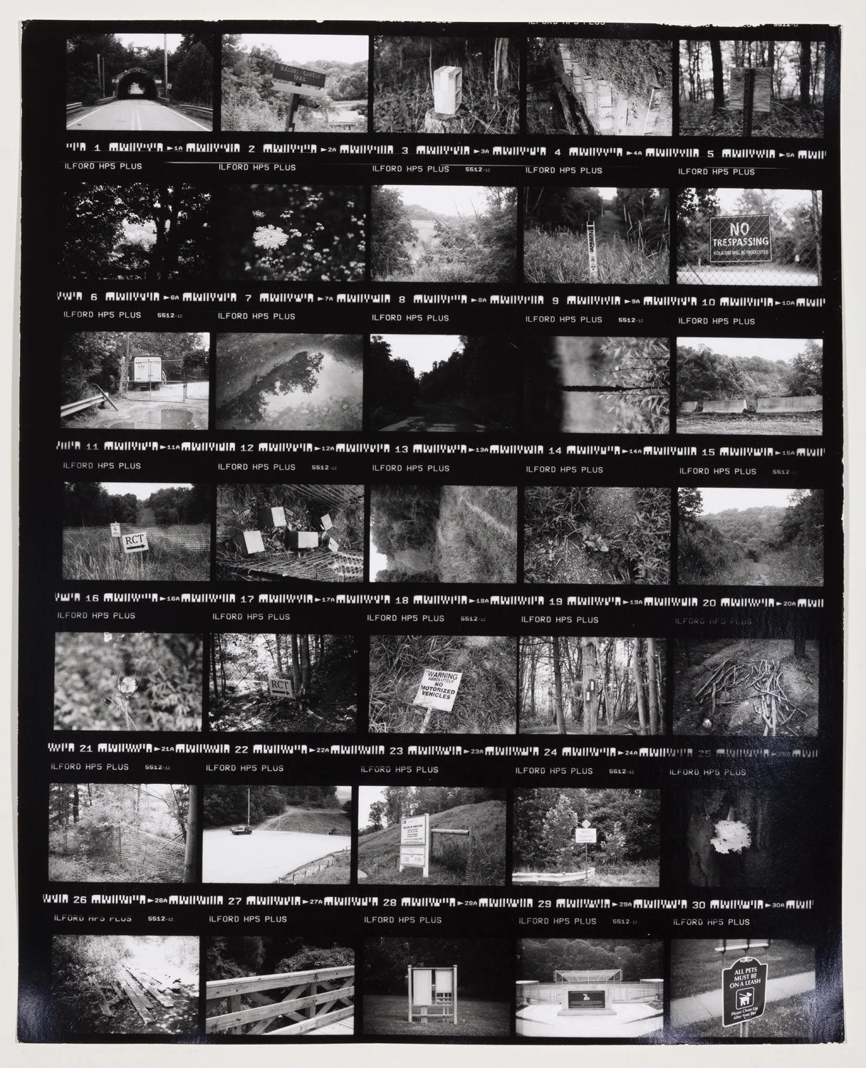


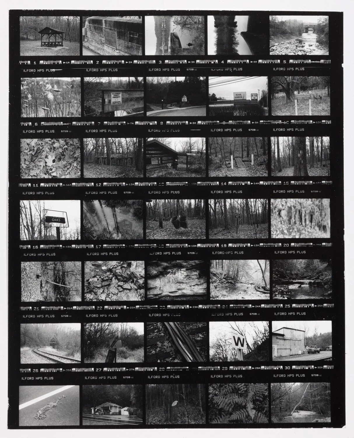


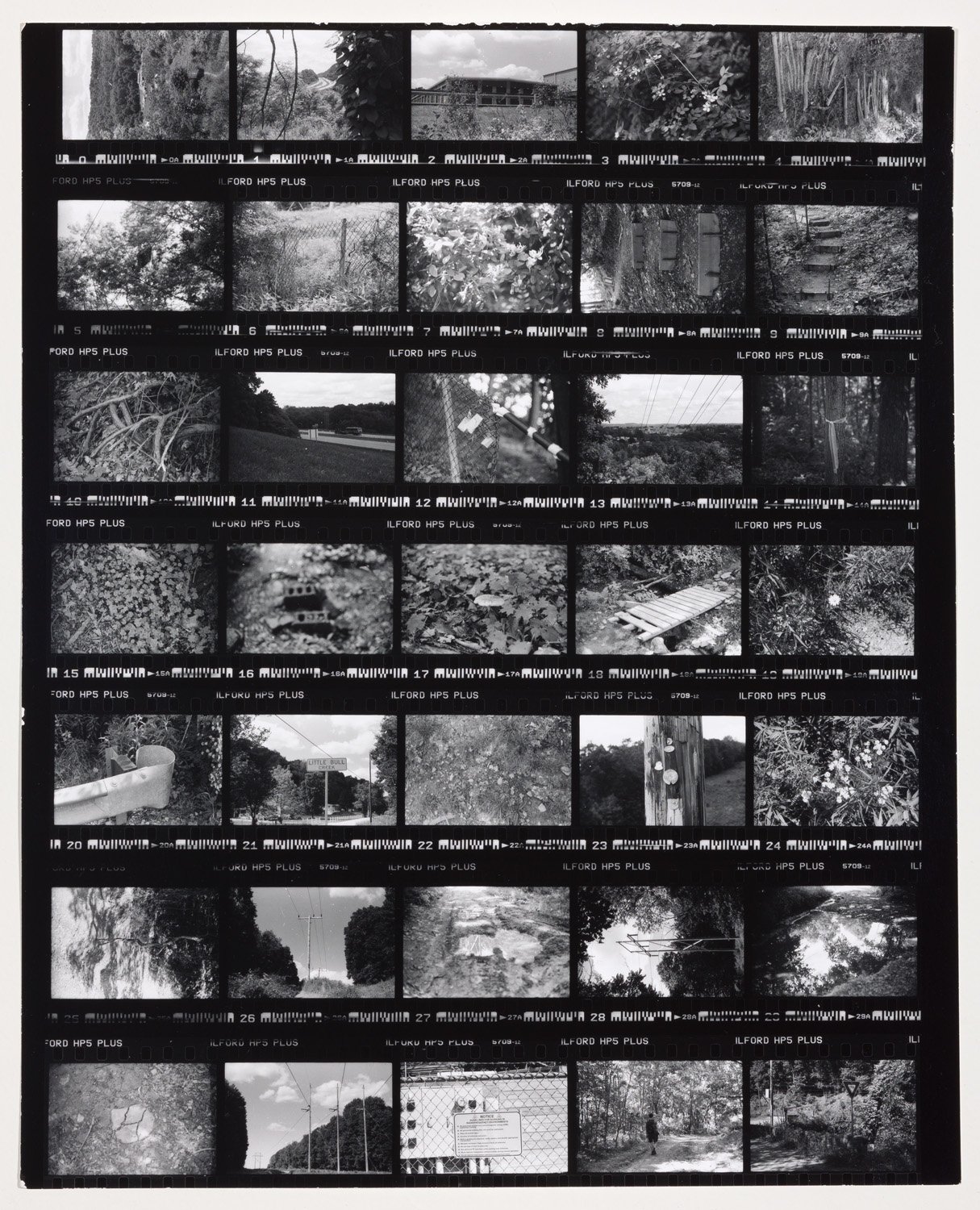

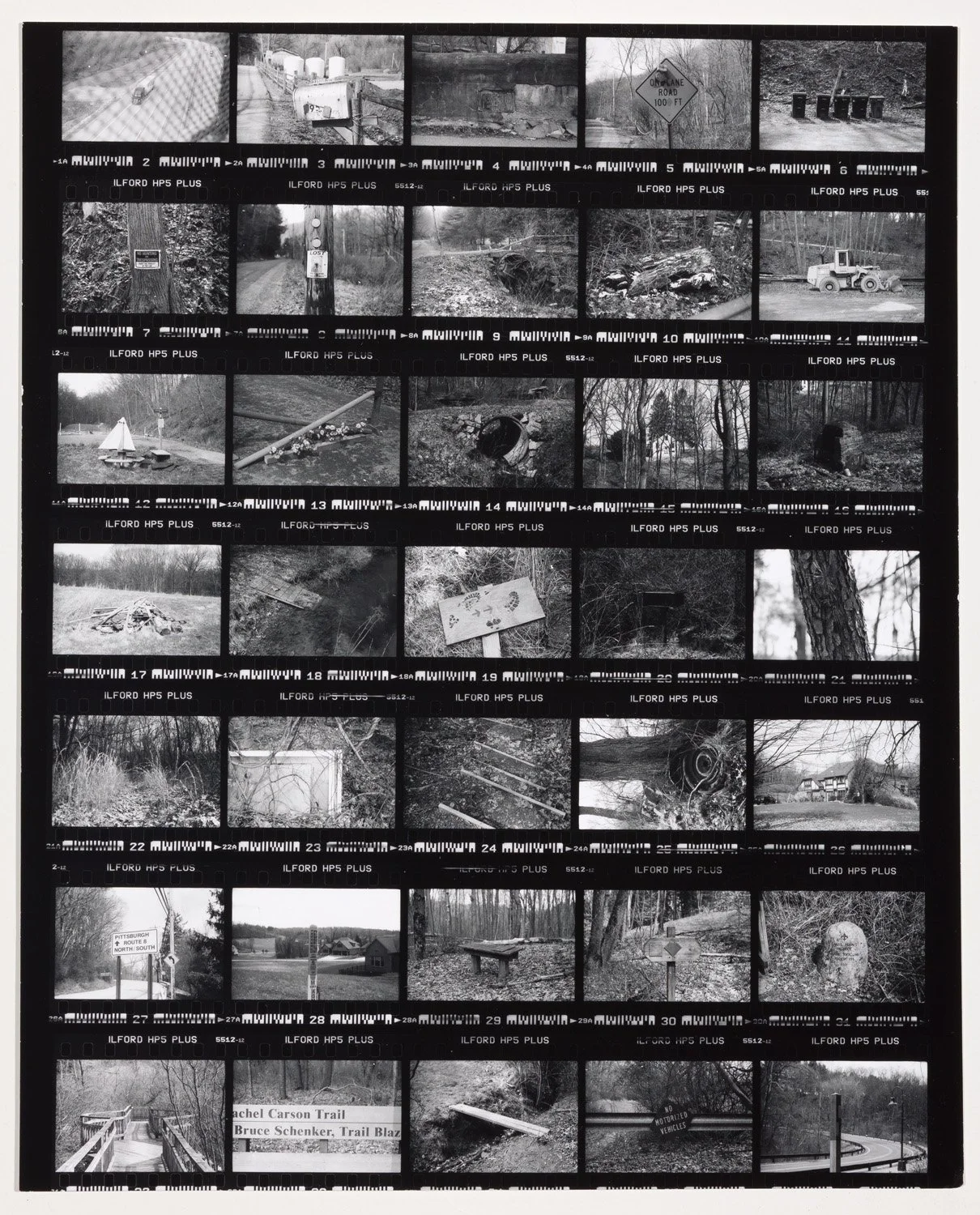


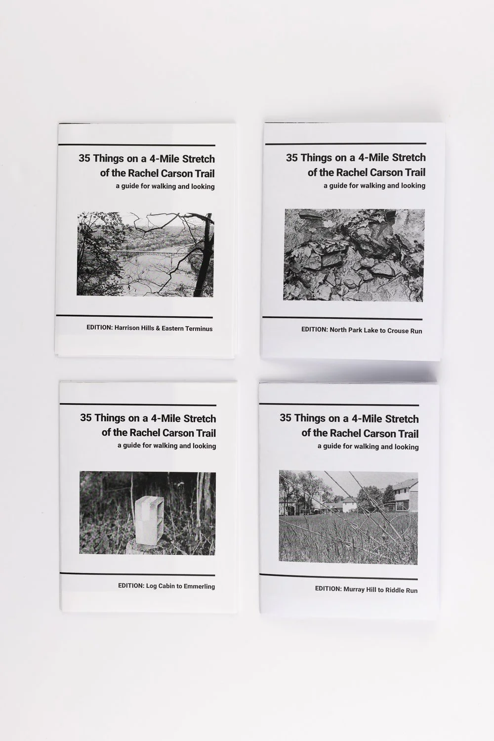
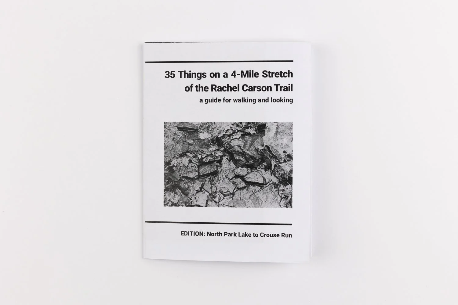
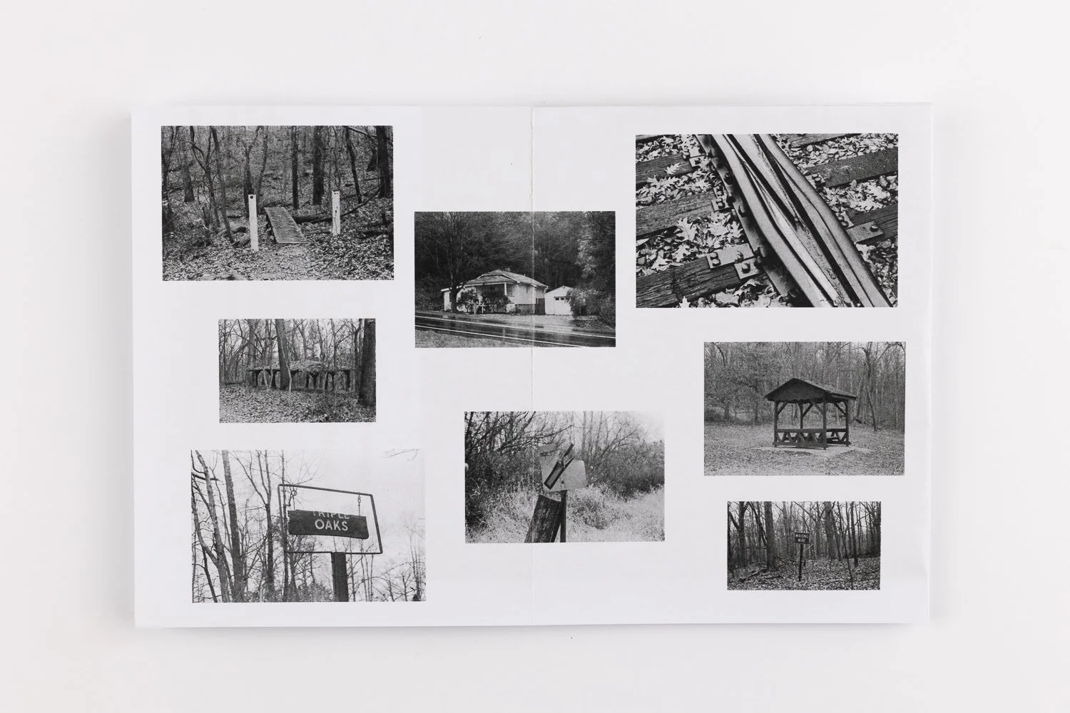
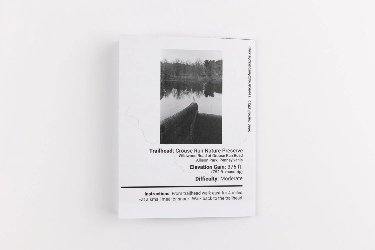
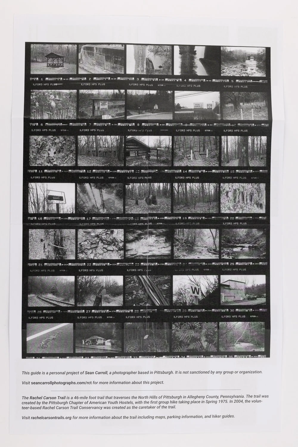
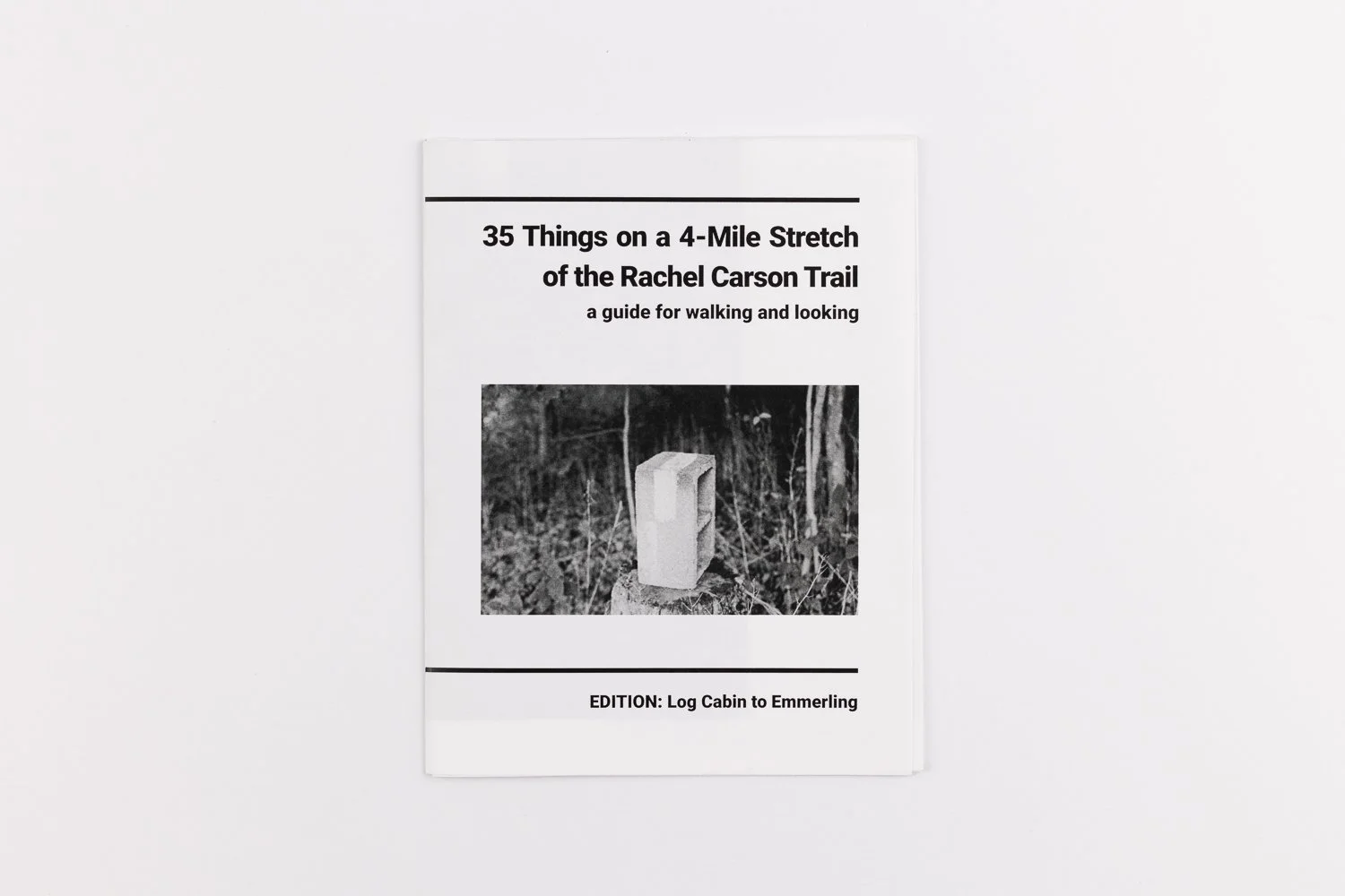
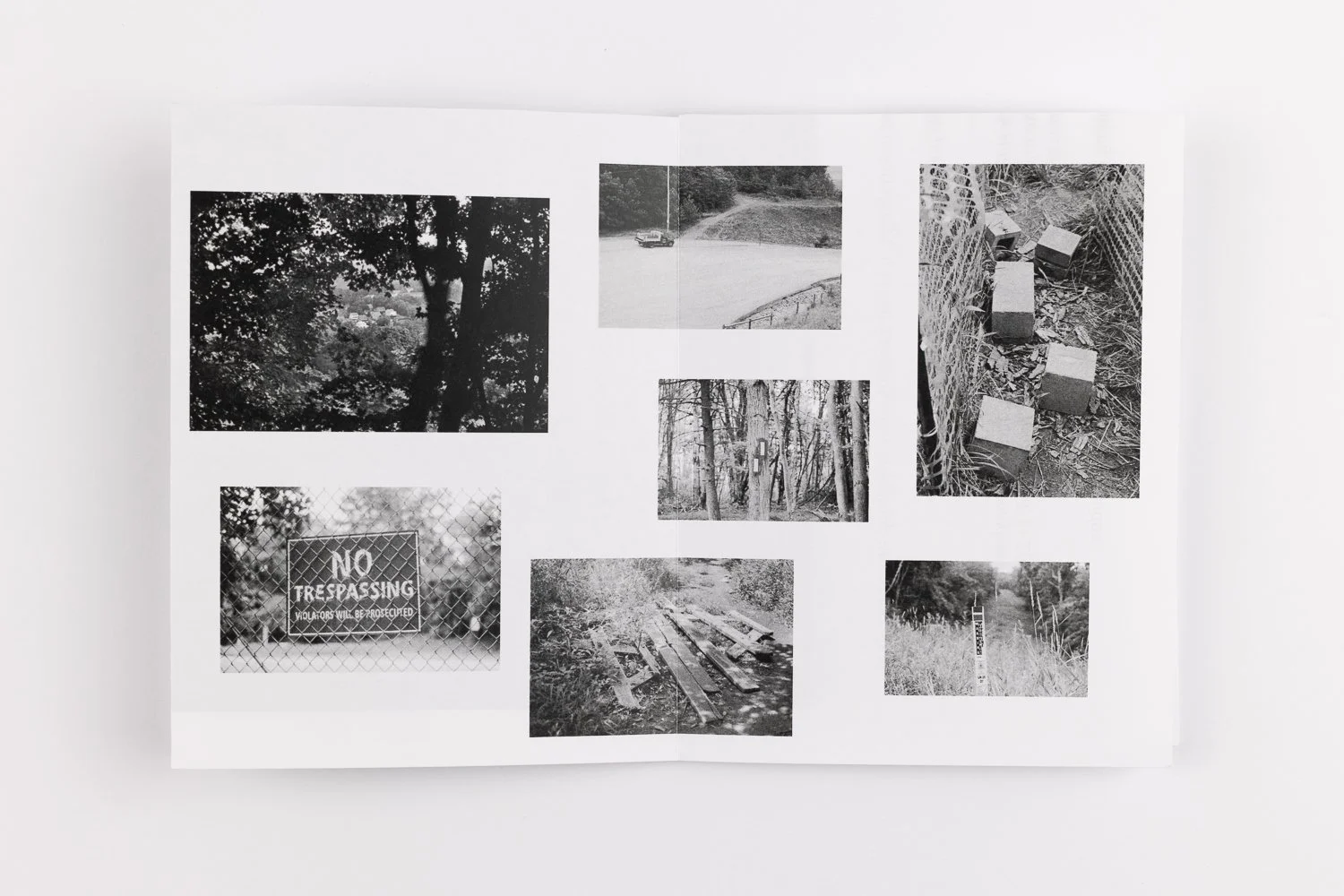
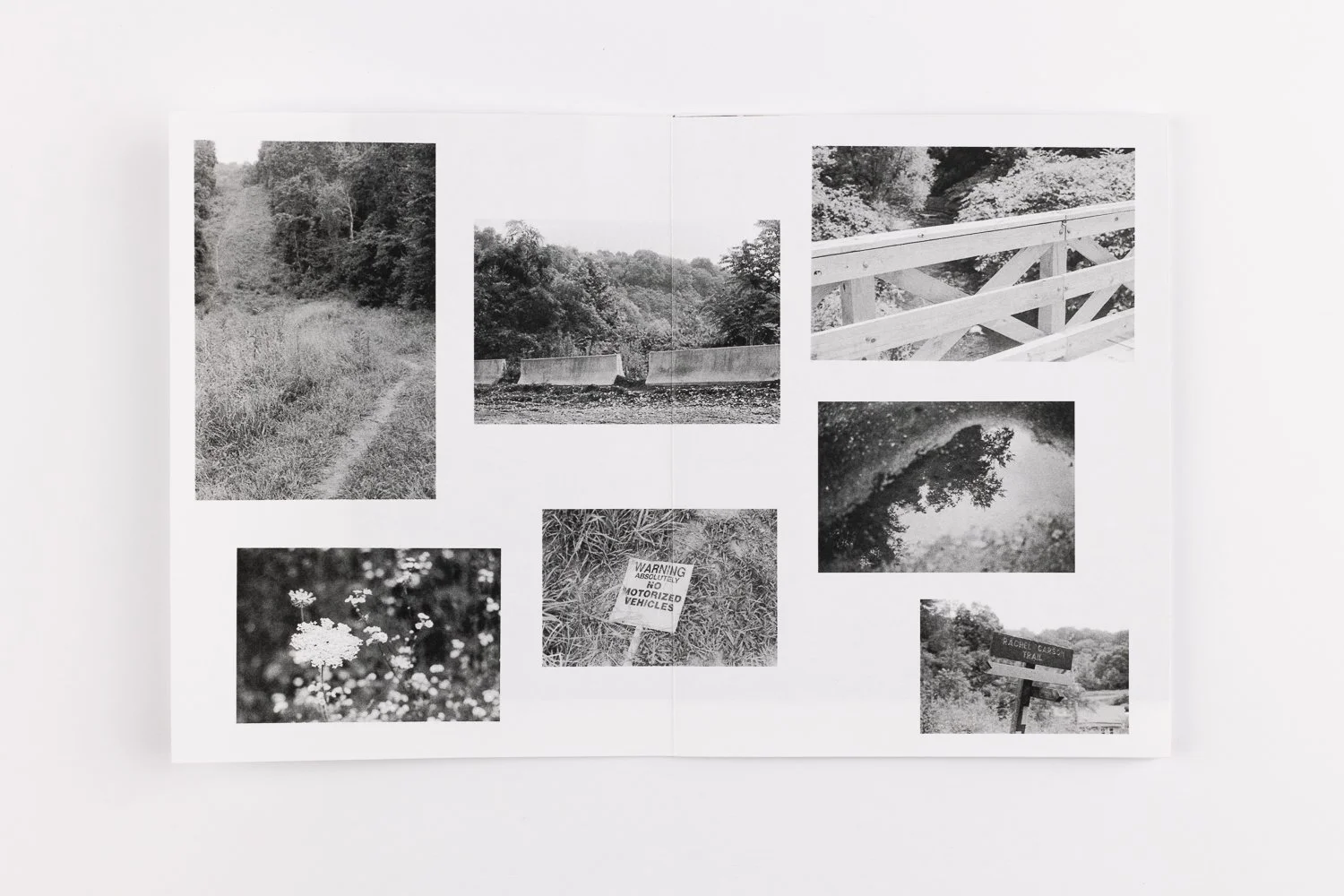
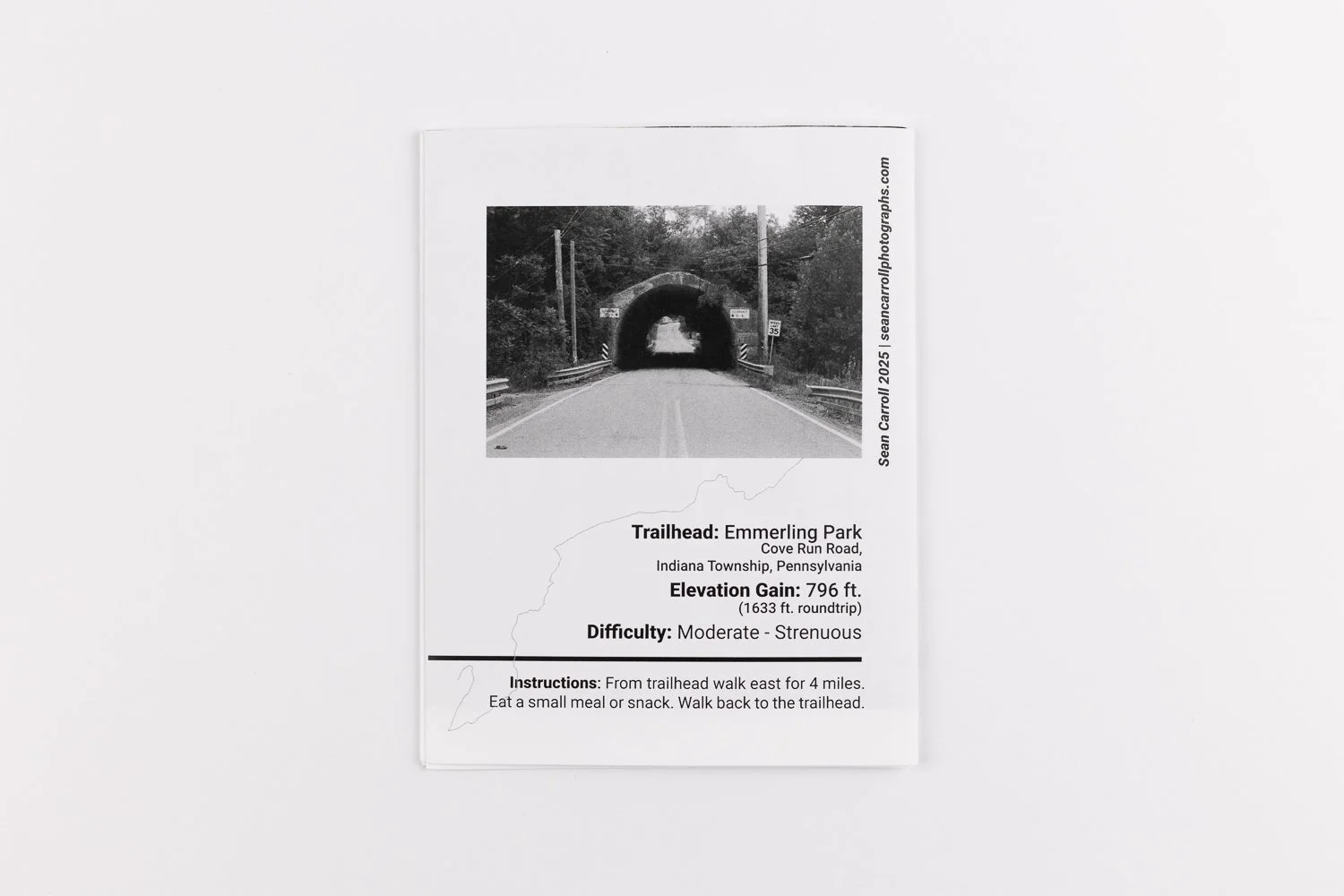
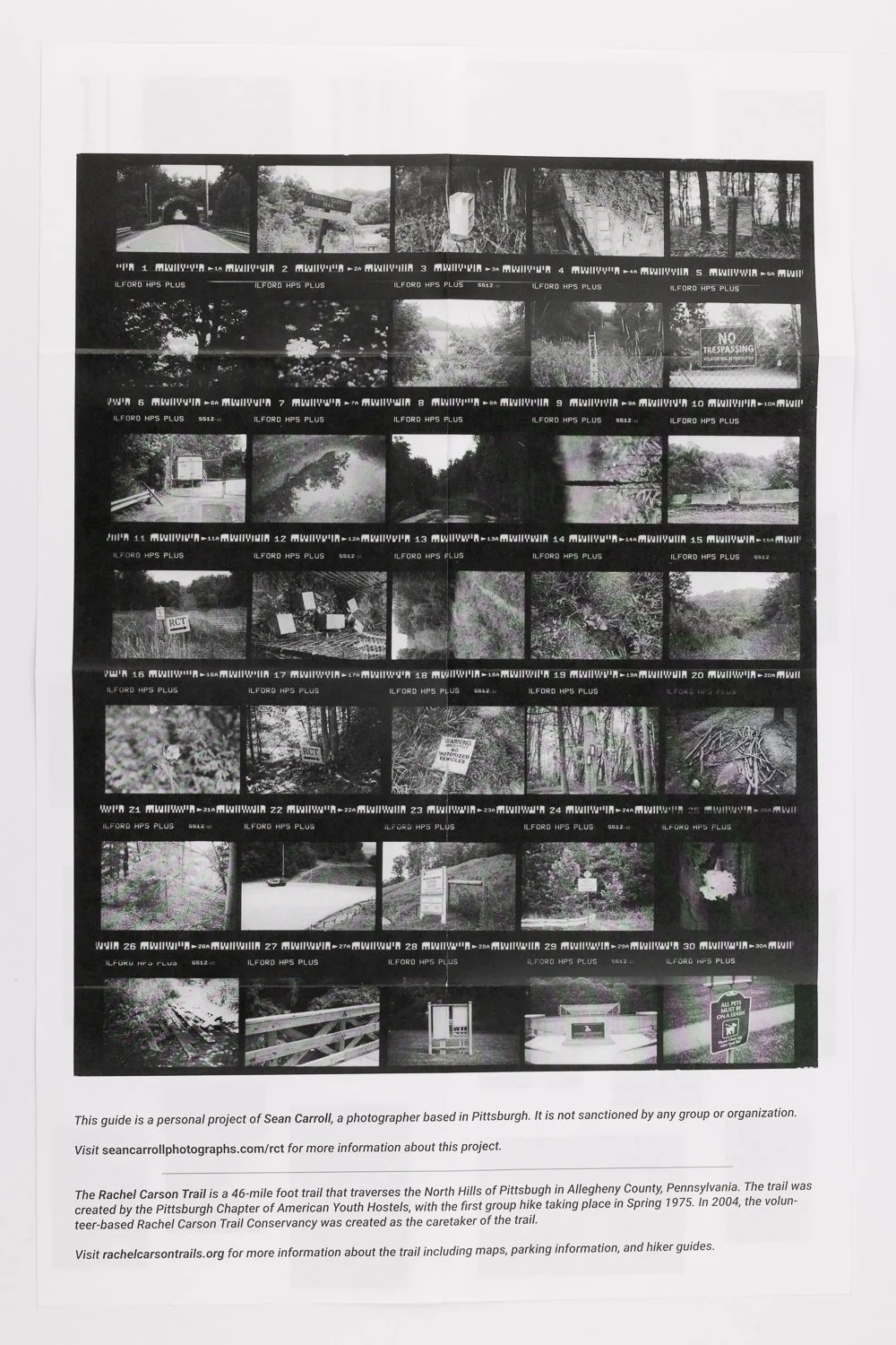
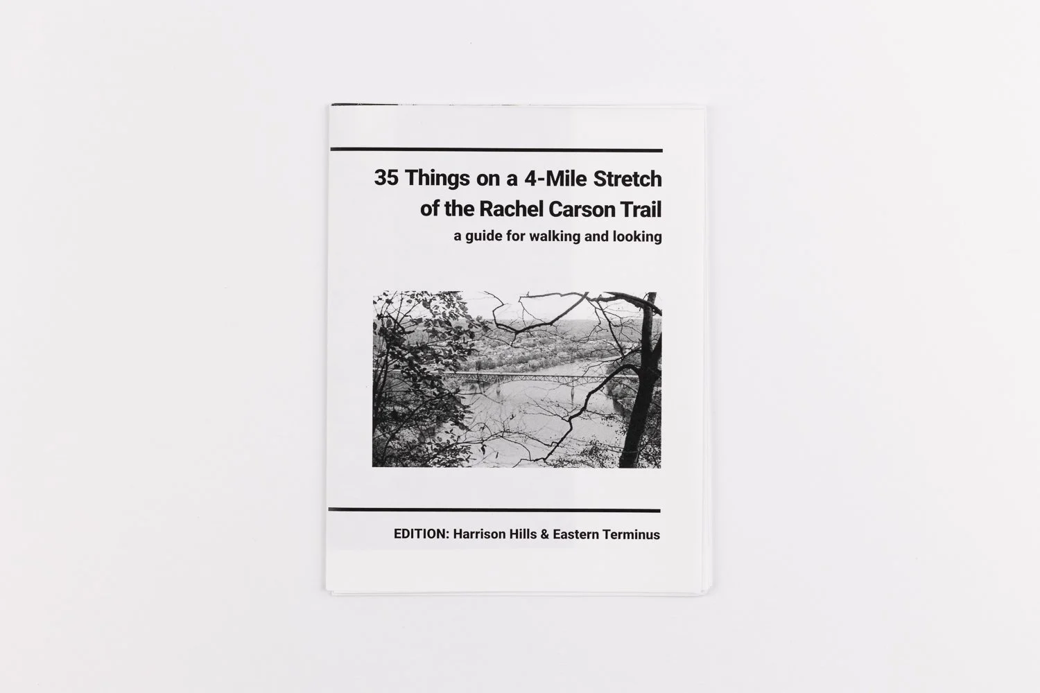
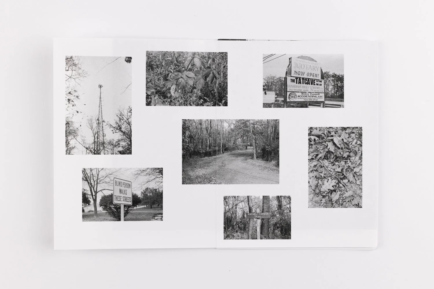
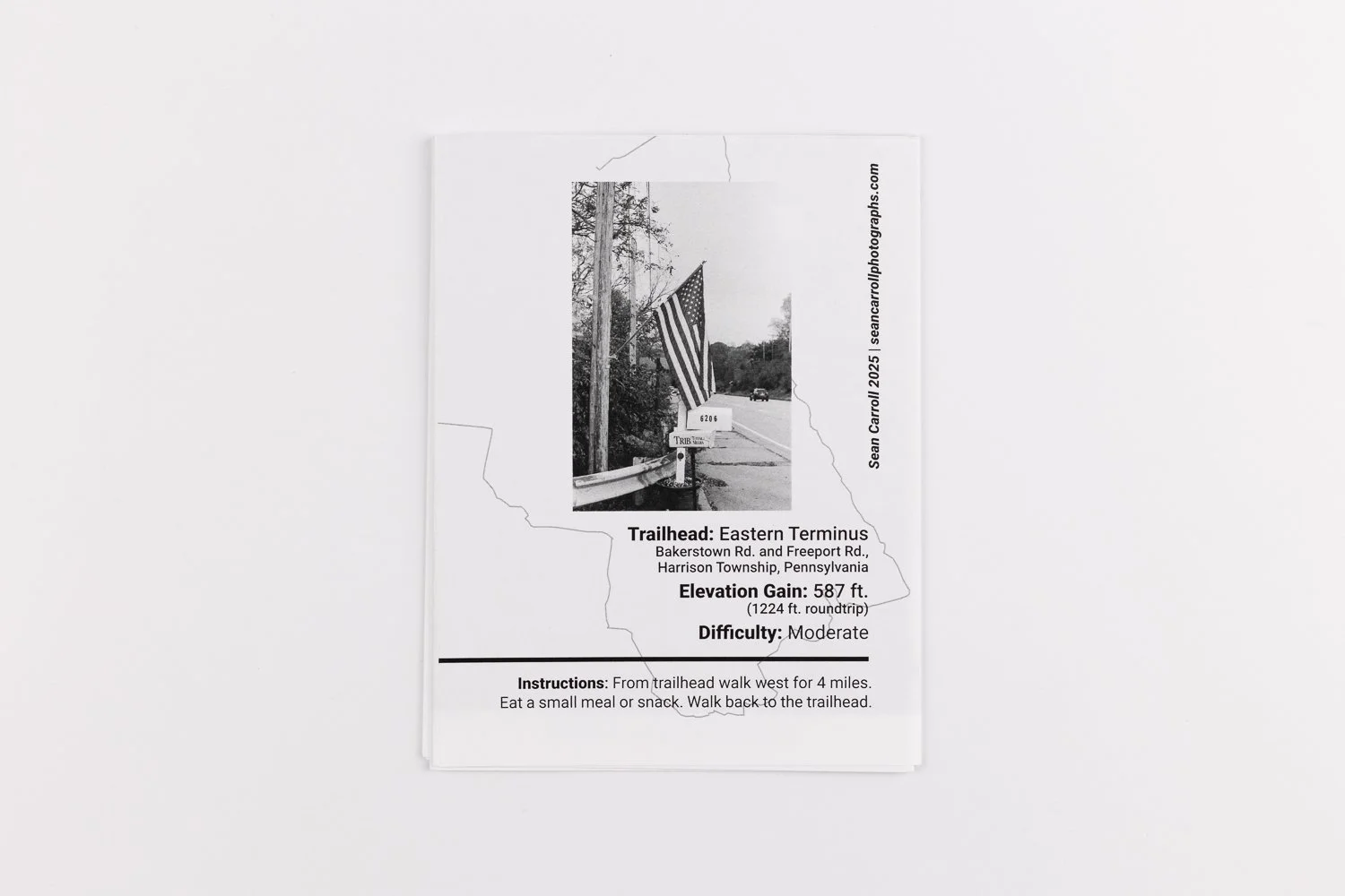
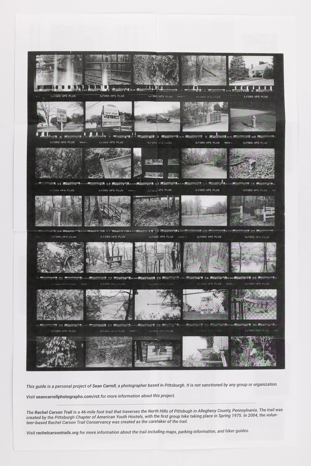
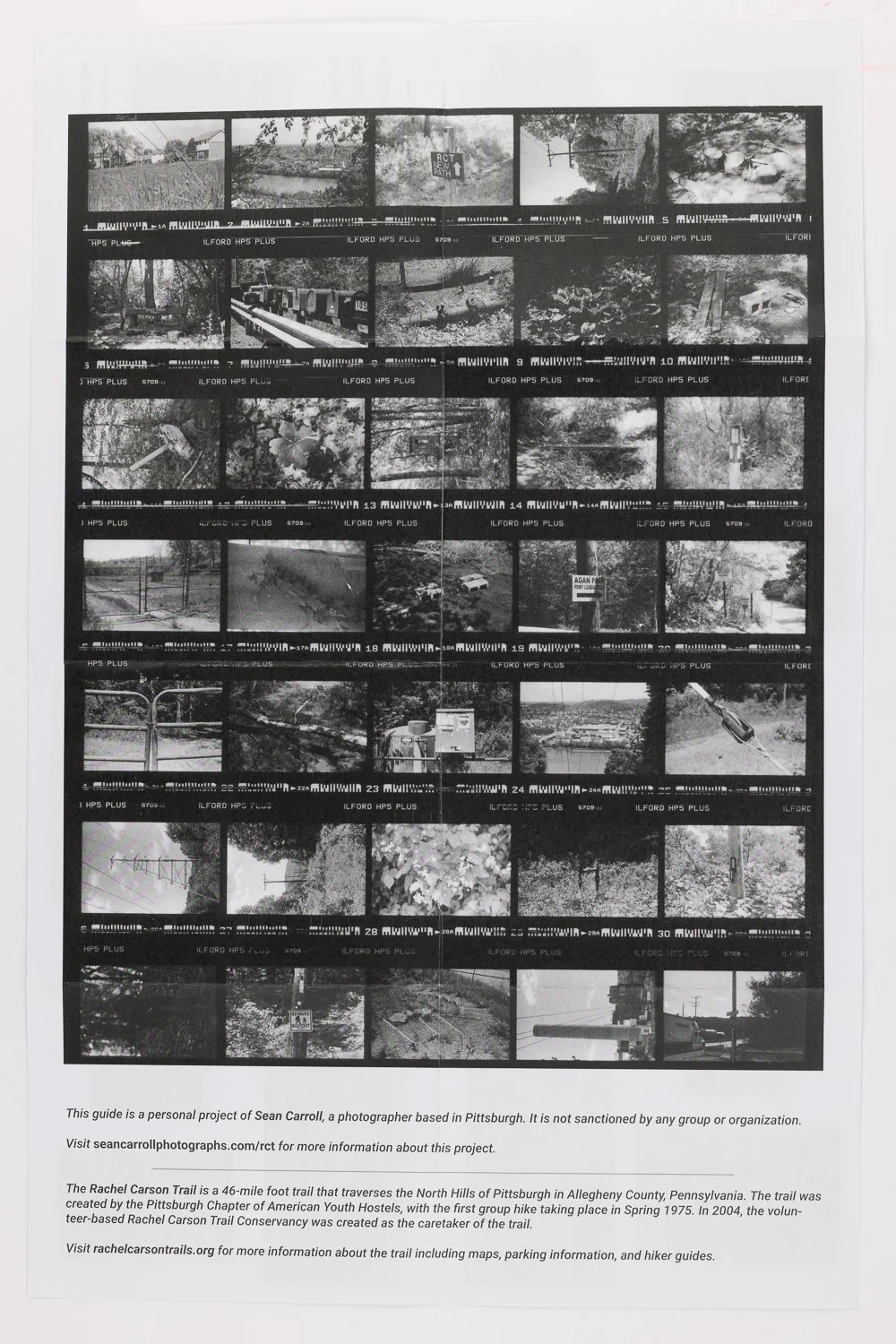
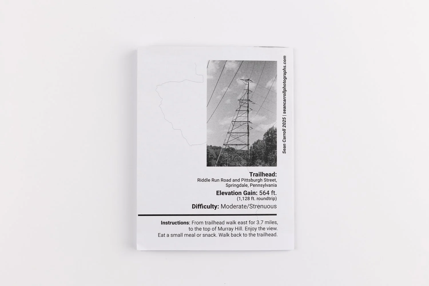
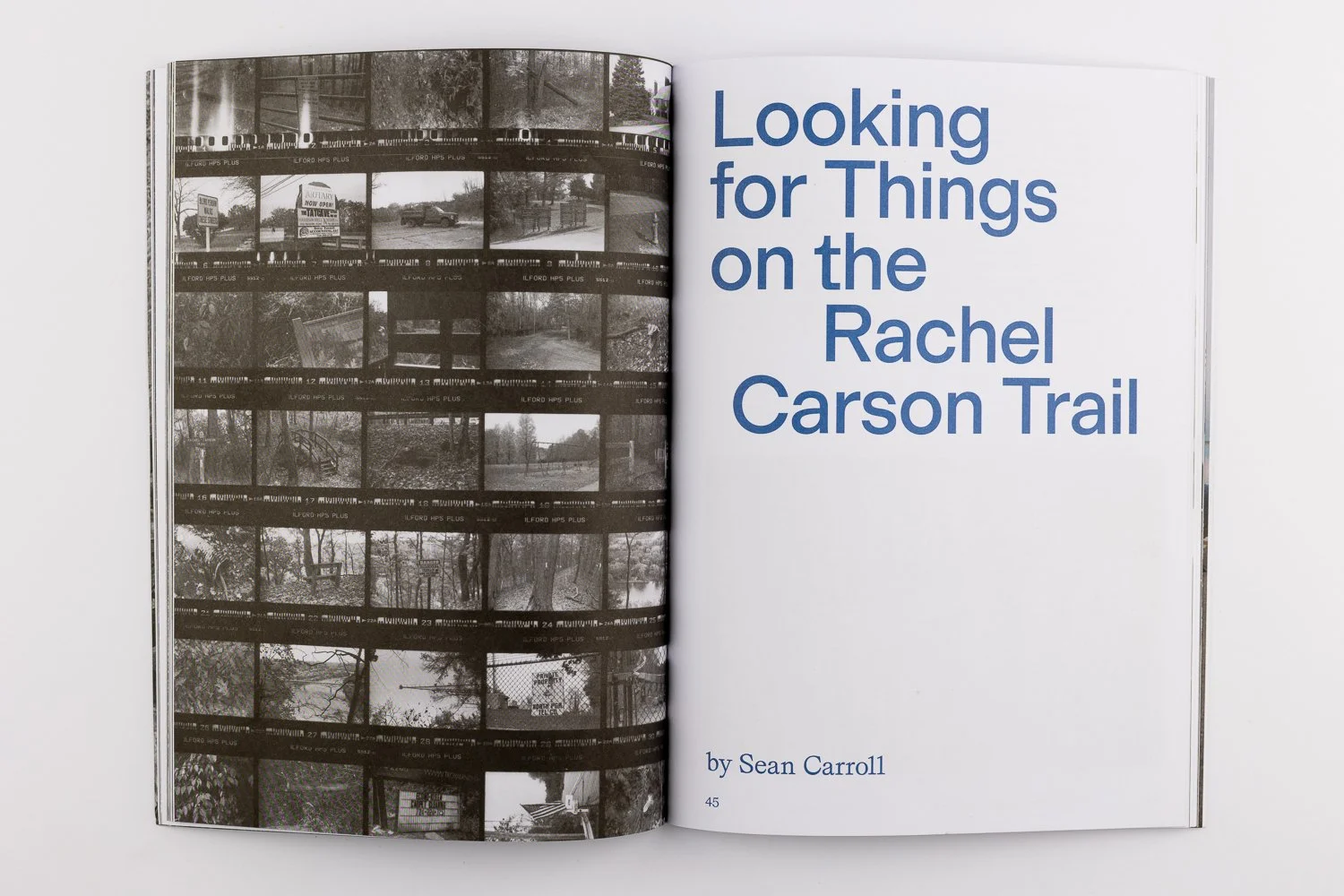
‘35 Things on a 4-Mile Stretch of the Rachel Carson Trail’ - A series of zines were developed with each edition encapsulating a hike taken during the project. The slit-style zines feature selected images taken during the hike, and opens up to show the contact sheet from the roll of film captured.
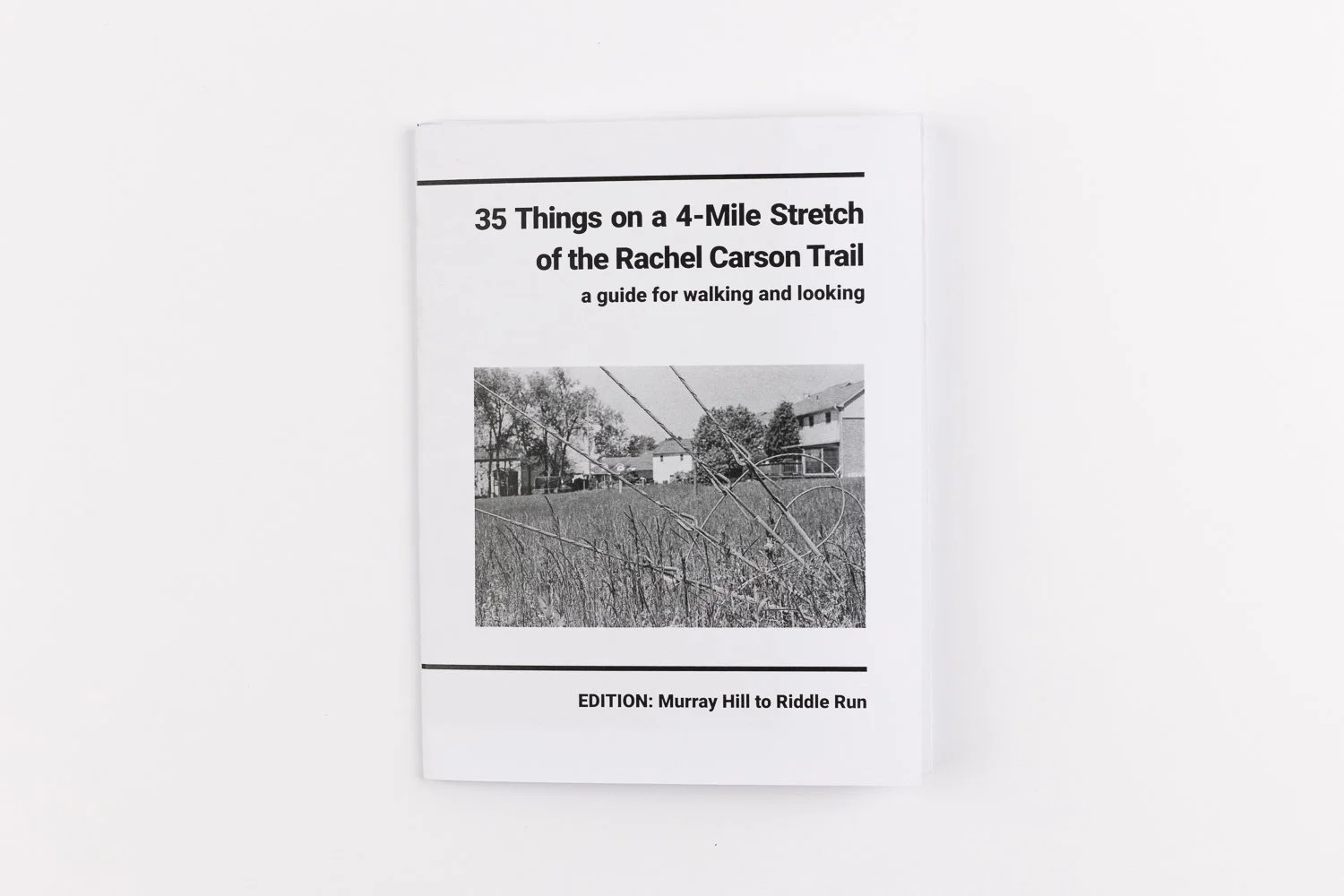
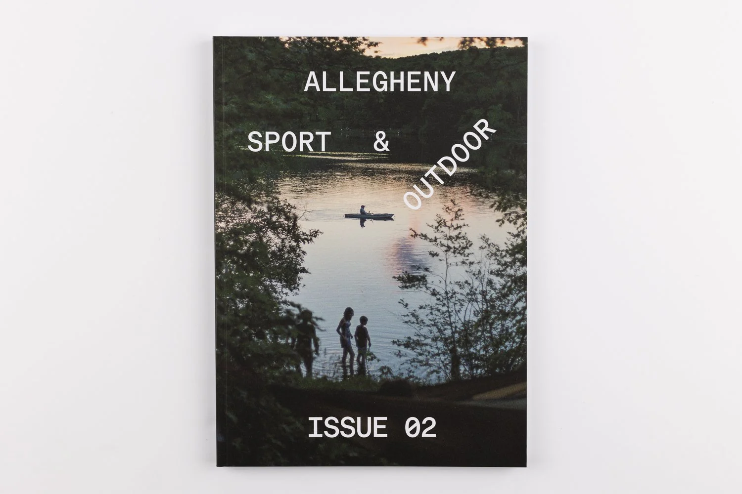
This essay and select images were published in Issue 2 of Allegheny Sport & Outdoor, Summer 2025
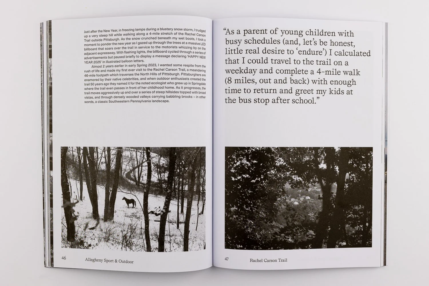
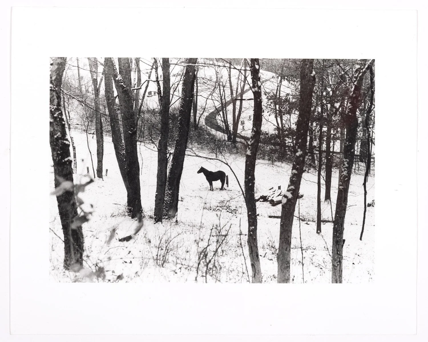
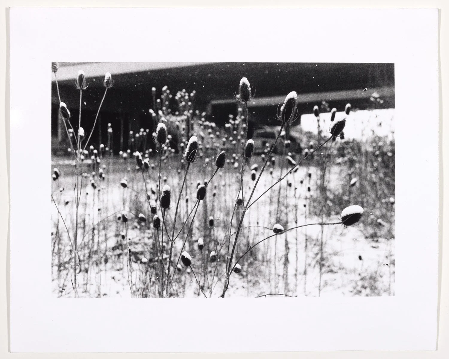
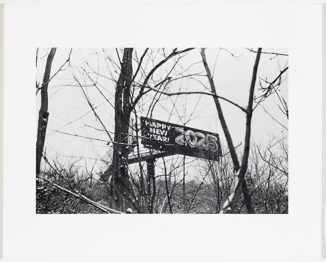
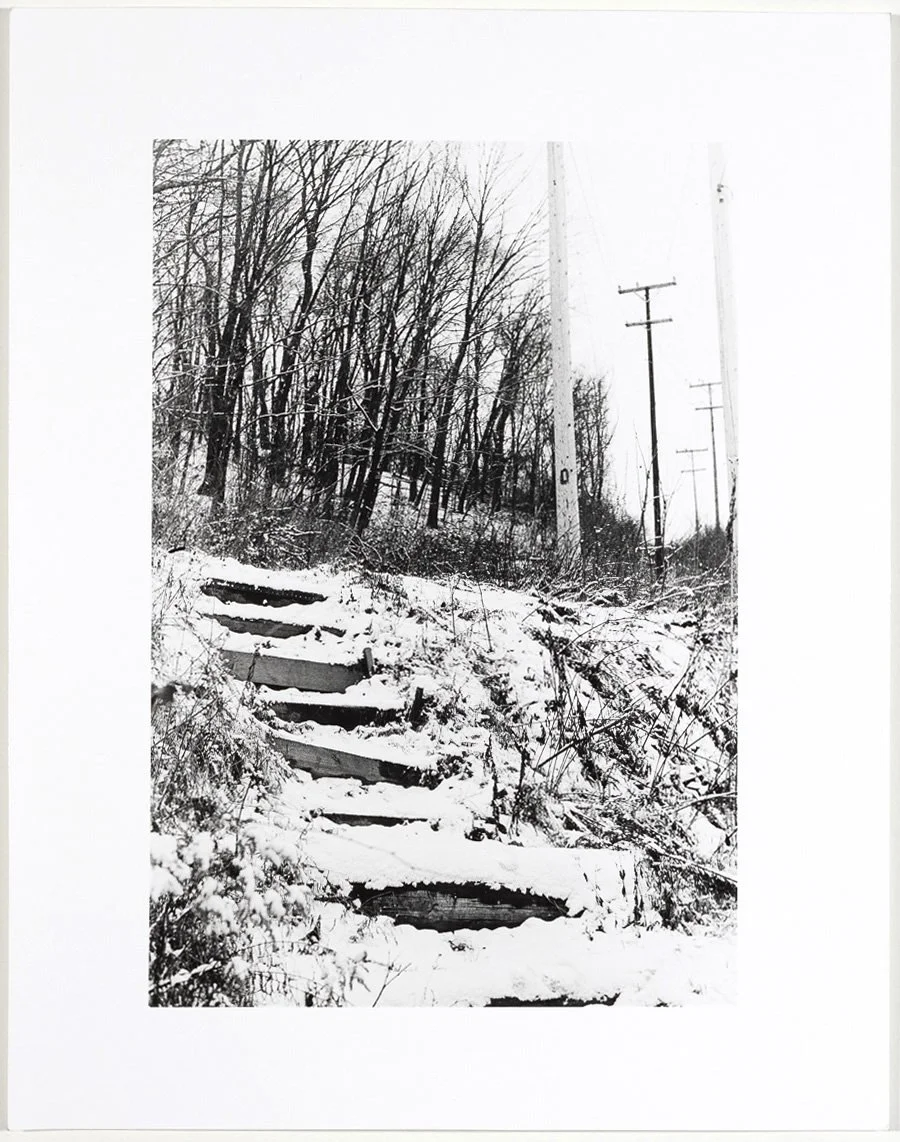
Just after the New Year, in freezing temps during a blustery snow storm, I trudged up a very steep hill while walking along a 4-mile stretch of the Rachel Carson Trail outside Pittsburgh. As the snow crunched beneath my wet boots I took a moment to ponder the new year as I gazed up through the trees at a massive LED billboard that soars over the trail in service to the motorists whizzing by on the adjacent expressway. With flashing lights the billboard cycled through a series of advertisements but paused briefly to display a message declaring ‘HAPPY NEW YEAR 2025’ in illustrated balloon letters.
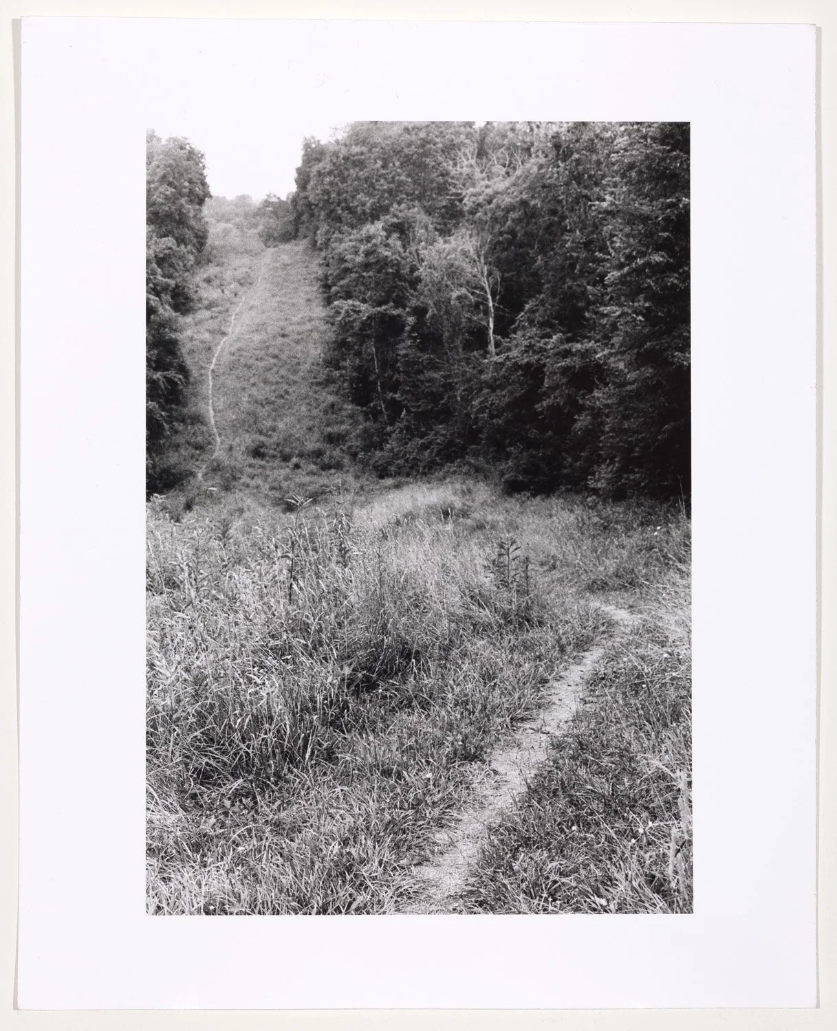
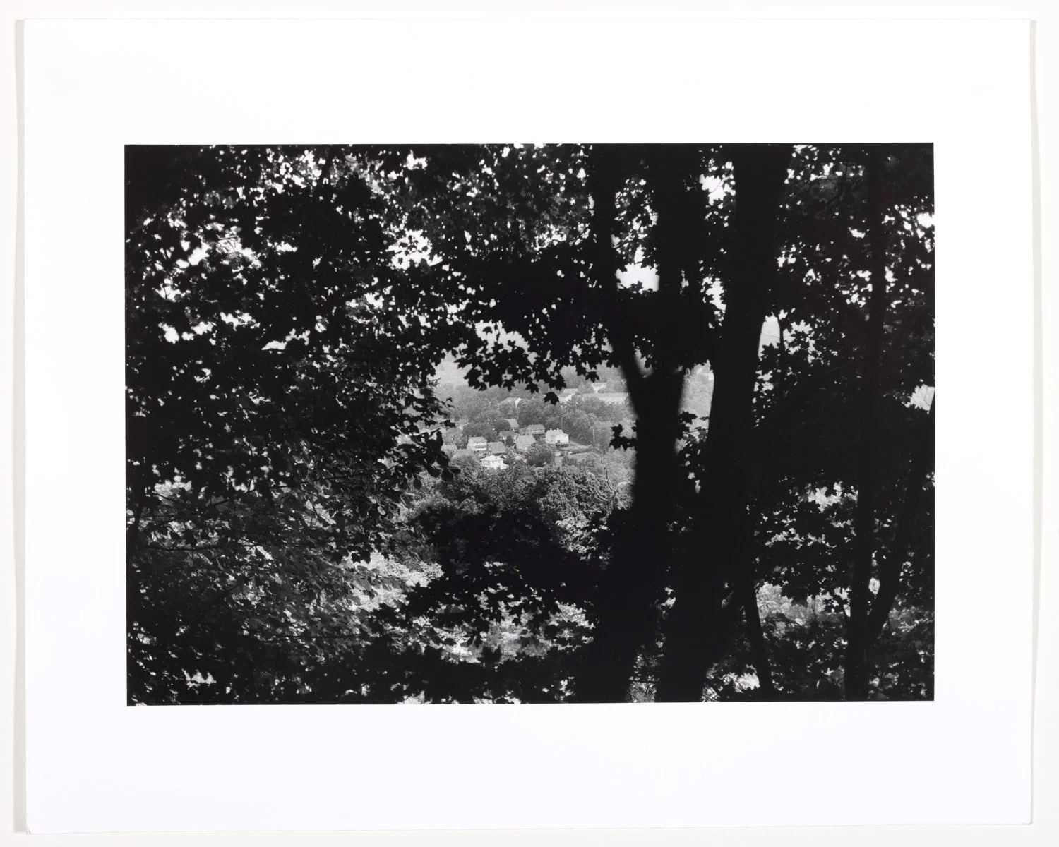
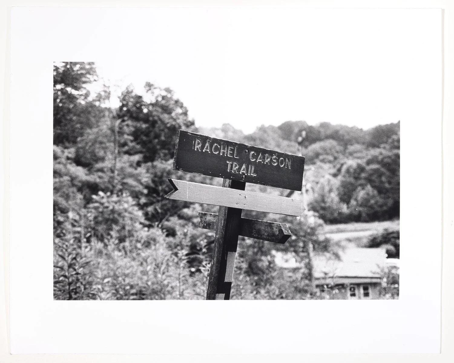
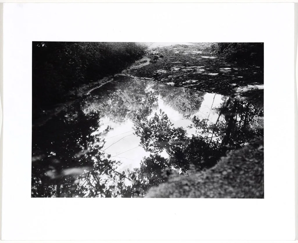
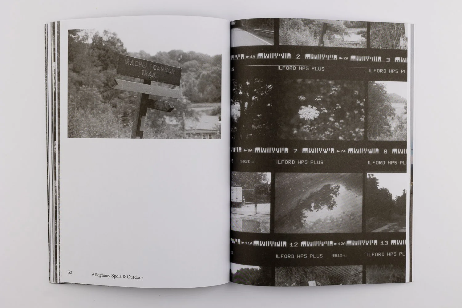
Almost 2 years earlier in early Spring 2023, I wanted some respite from the rush of life and made my first ever visit to the Rachel Carson Trail, a meandering 46-mile footpath which traverses the North Hills of Pittsburgh. Pittsburghers are enamored by their native celebrities, and when outdoor enthusiasts created the trail 50 years ago they named it for the noted ecologist who grew up in Springdale where the trail even passes in front of her childhood home. As it progresses, the trail moves aggressively up and over a series of steep hillsides topped with broad vistas, and through densely wooded valleys carrying babbling brooks – in other words, a classic Southwestern Pennsylvania landscape.
The trail is widely known for its annual Rachel Carson Challenge, a promotional and fundraising event, during which hikers and trail runners of all ages and abilities train for months to complete the entire trail in one day - a feat of dedication and endurance, to be sure. As a parent of young children with busy schedules (and, let’s be honest, little real desire to ‘endure’) I calculated that I could travel to the trail on a weekday and complete a 4-mile walk (8 miles, out and back) with enough time to return and greet my kids at the bus stop after school. My first walk on the Rachel Carson Trail was a revelation.
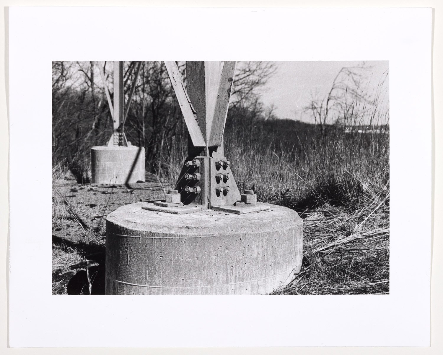
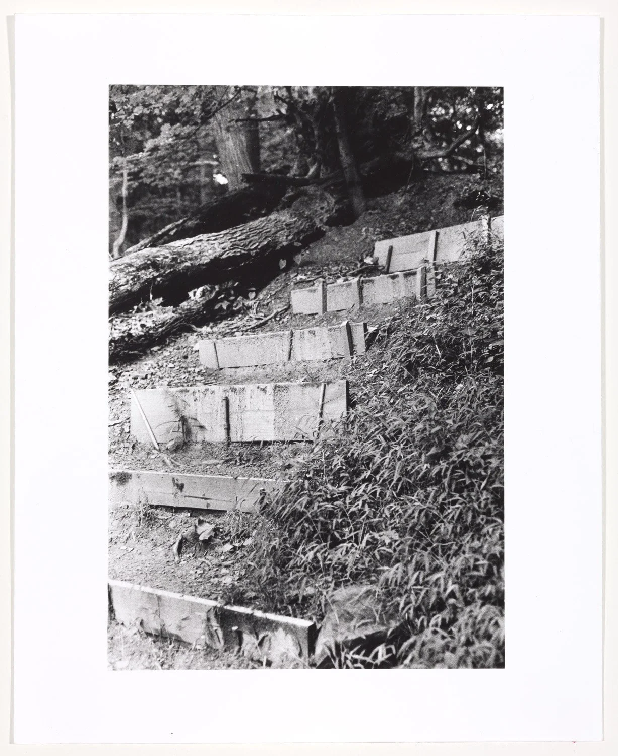
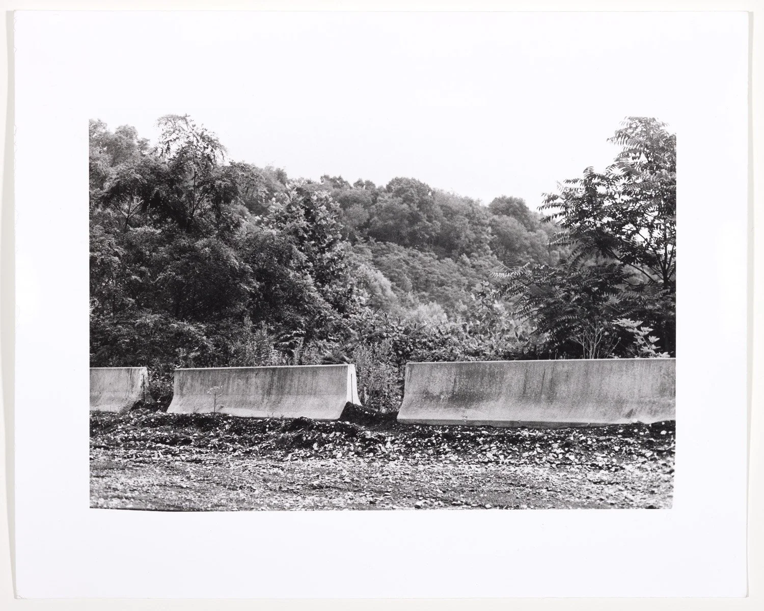
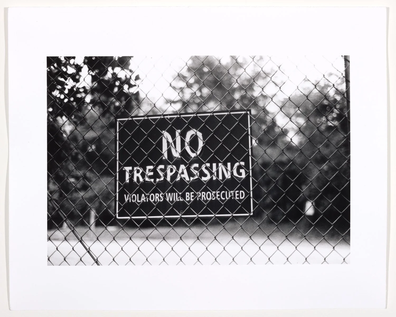
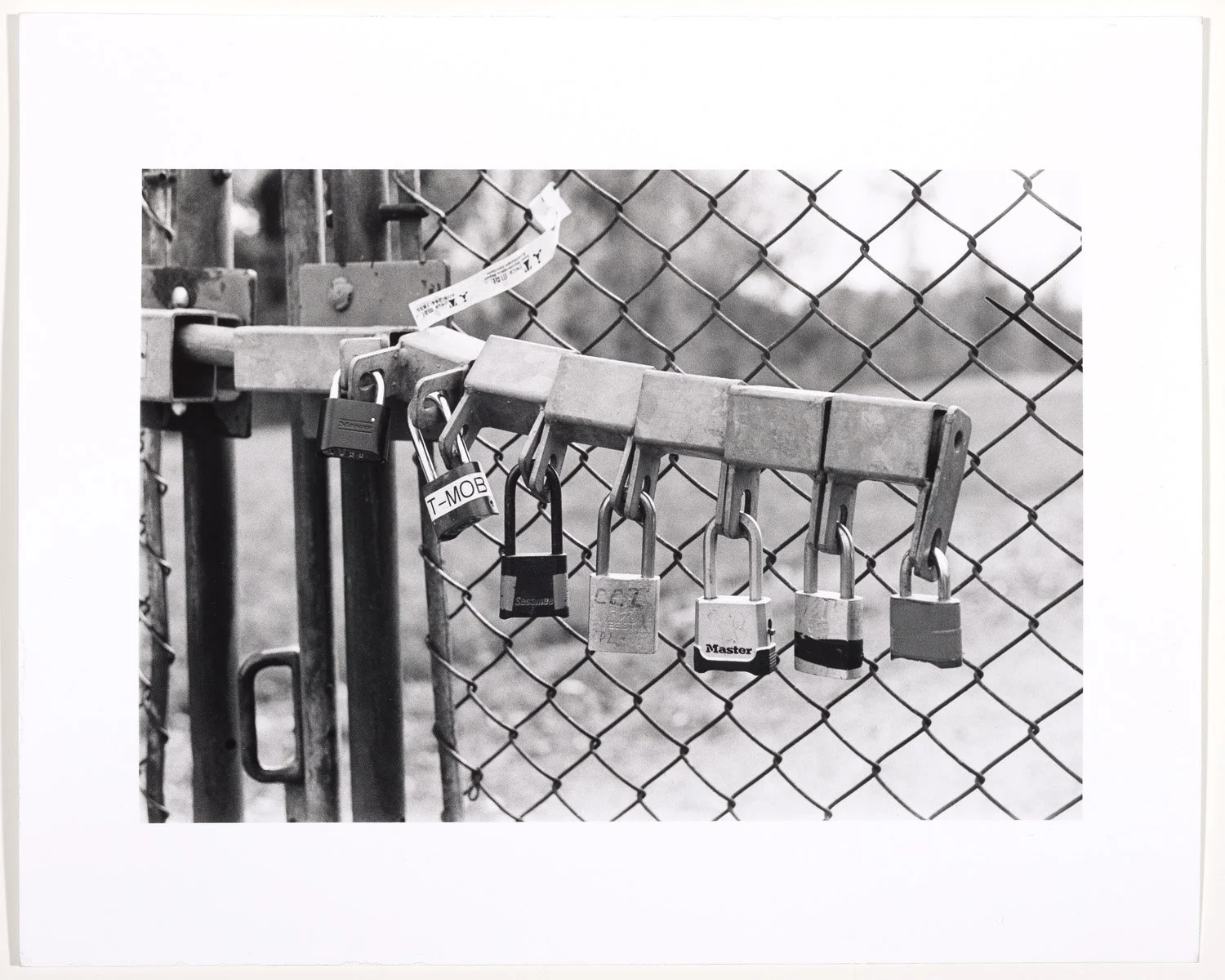
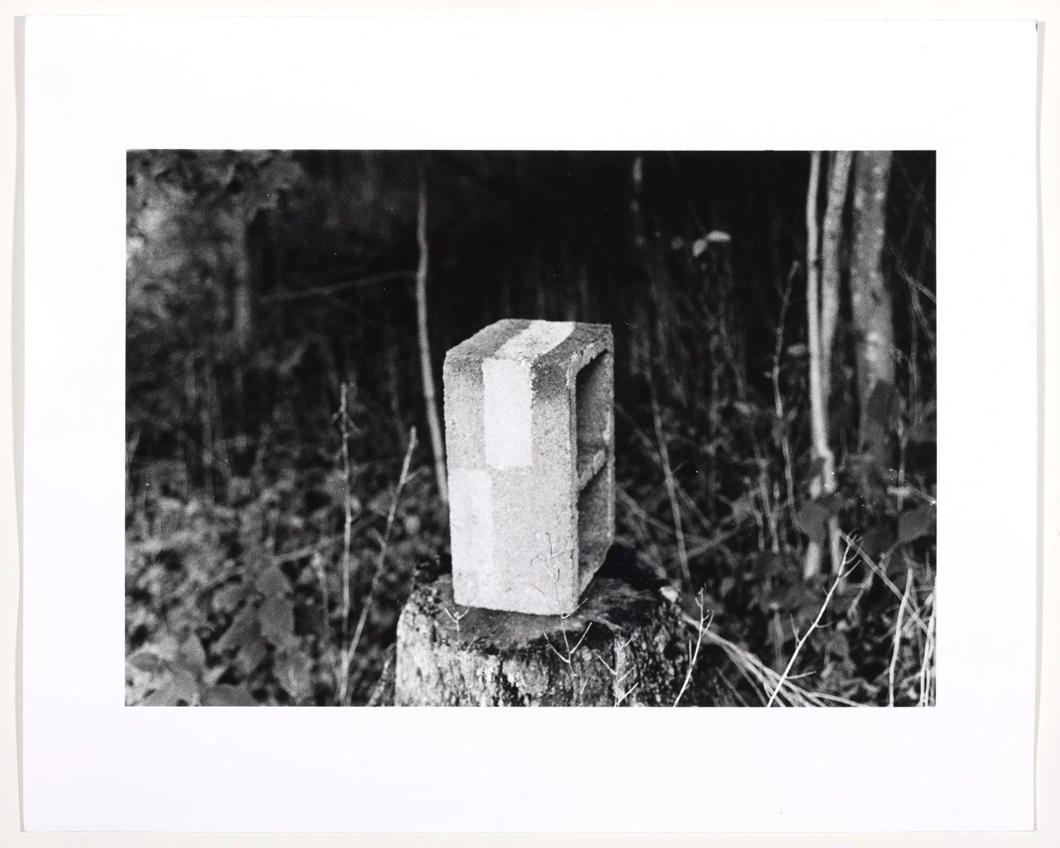
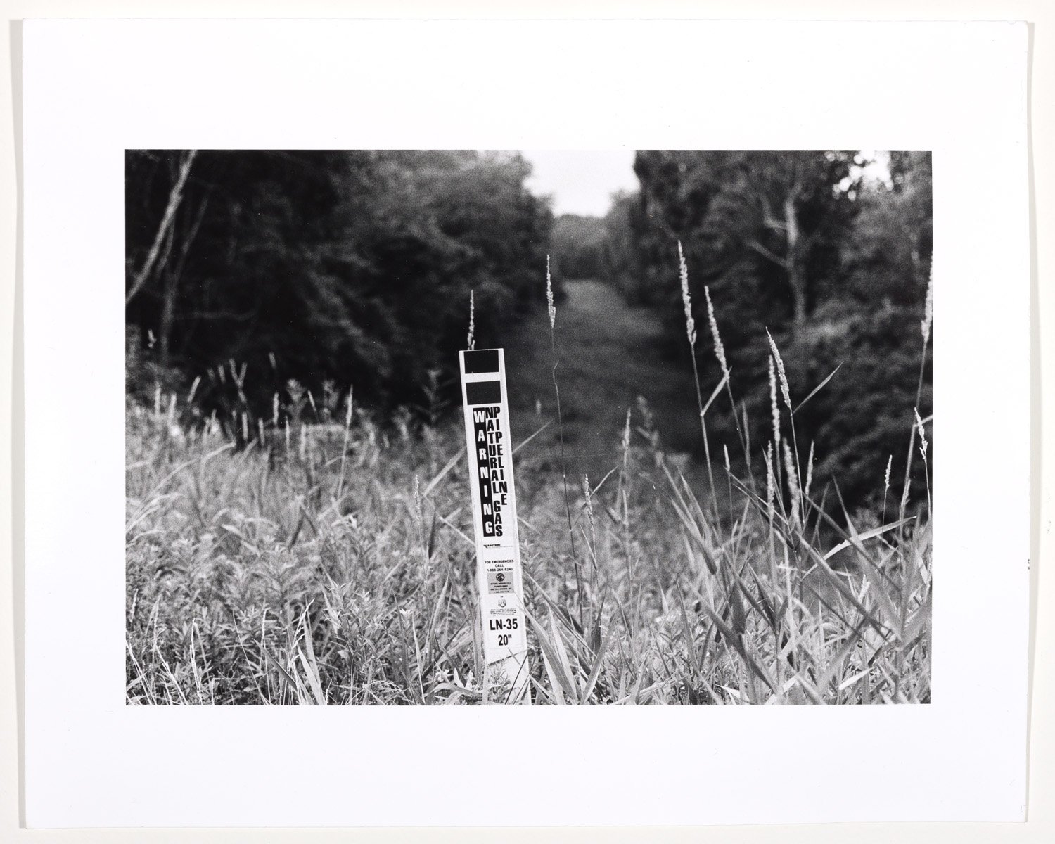
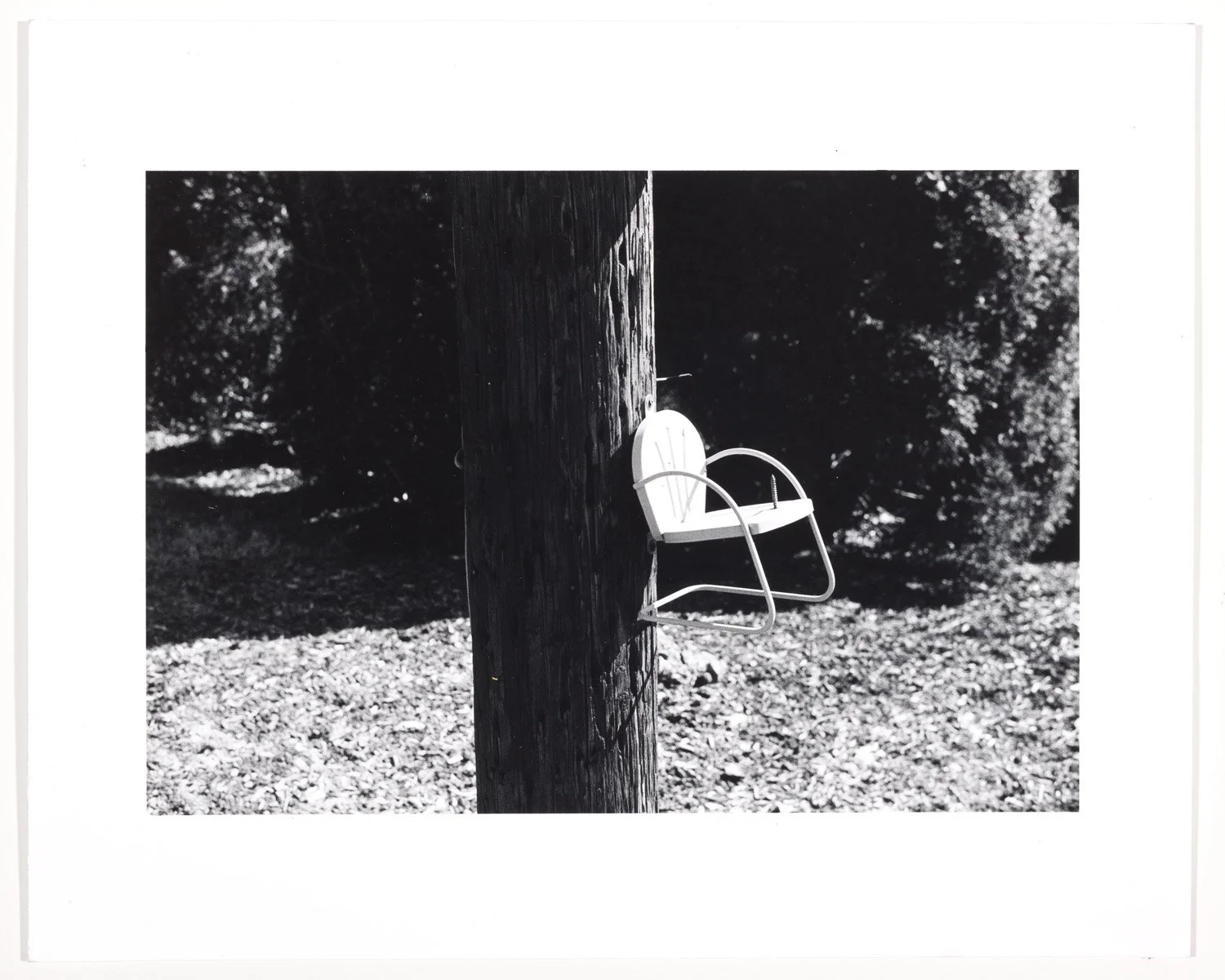
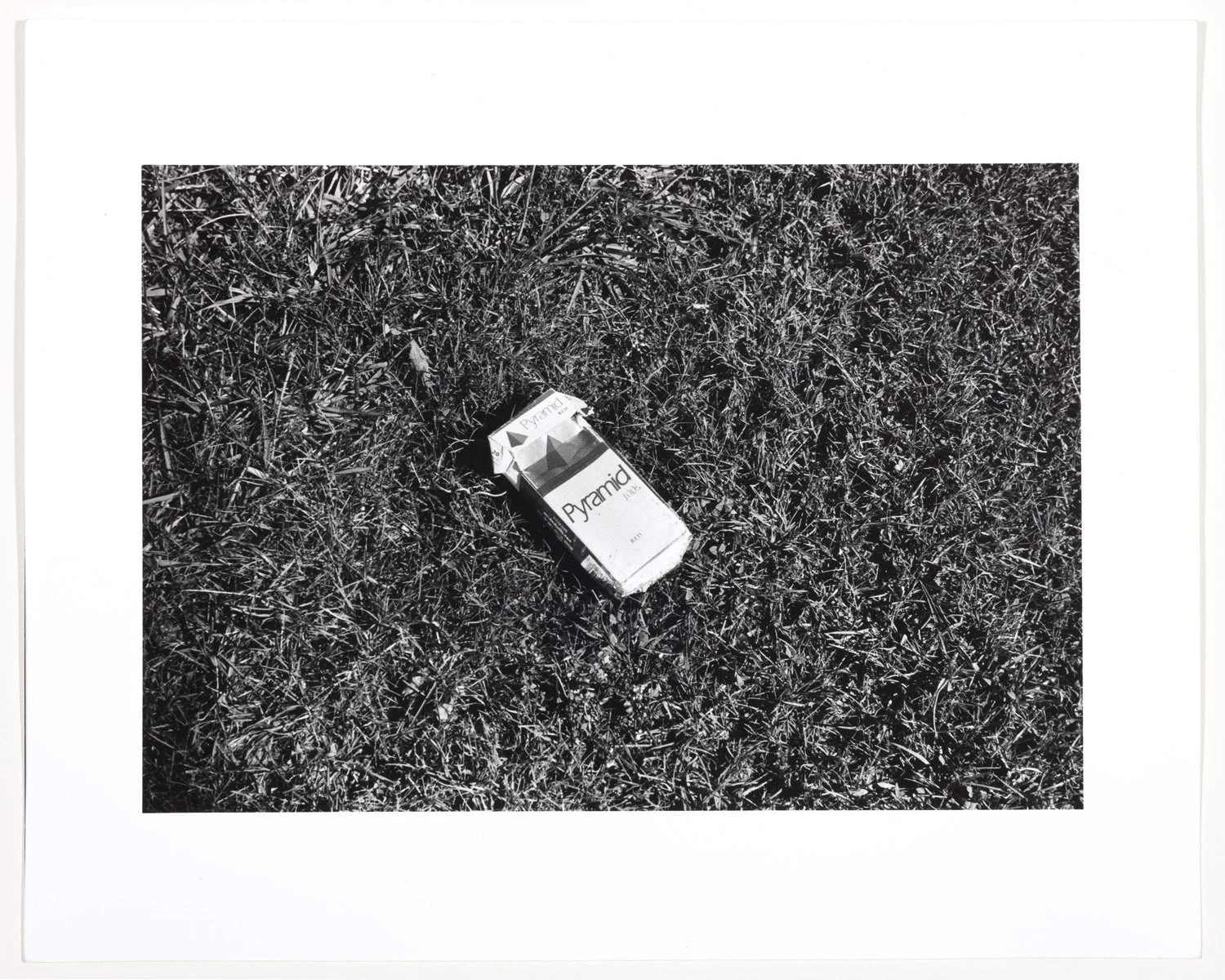
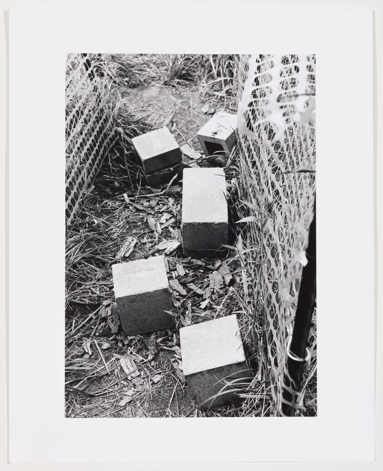
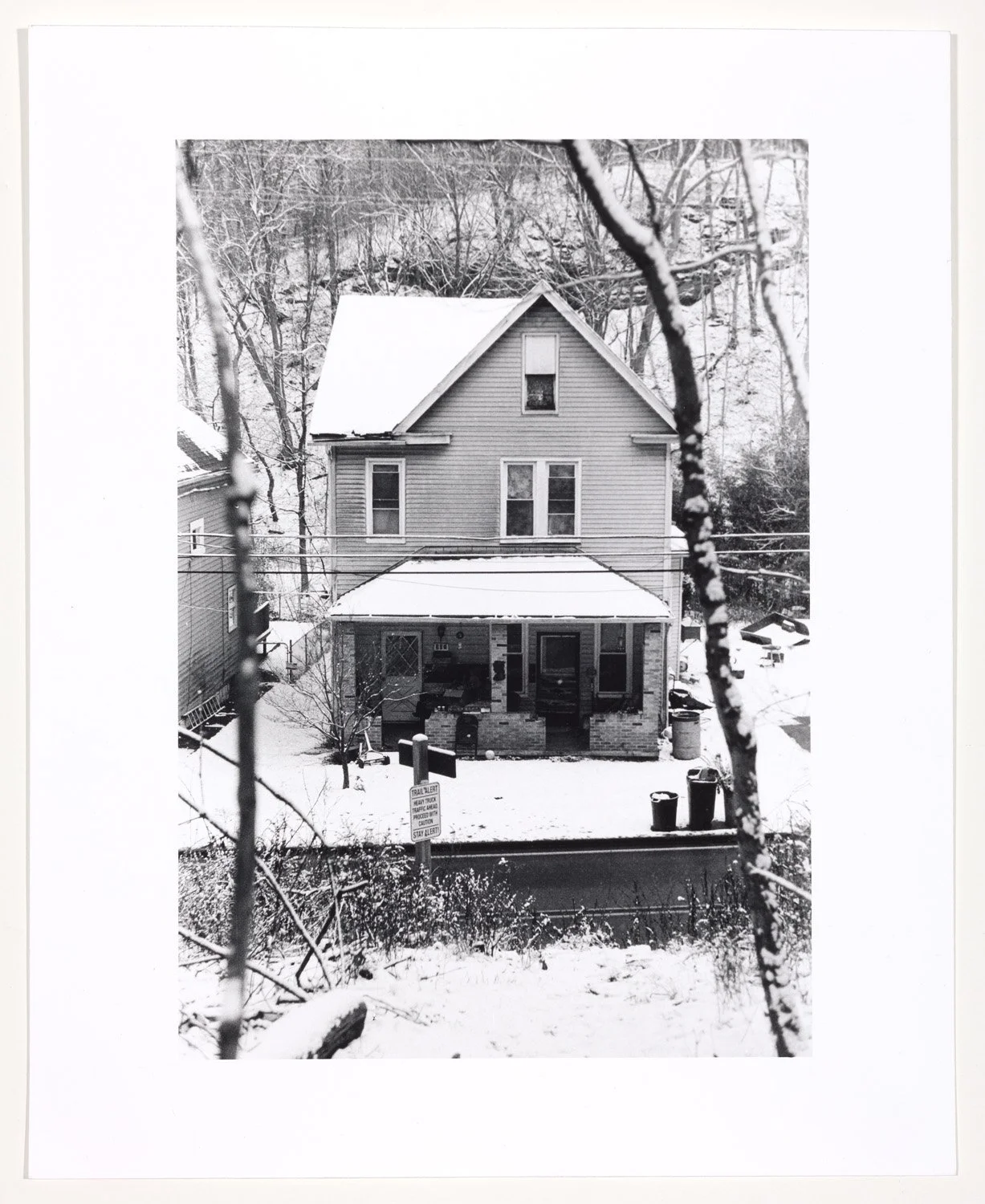
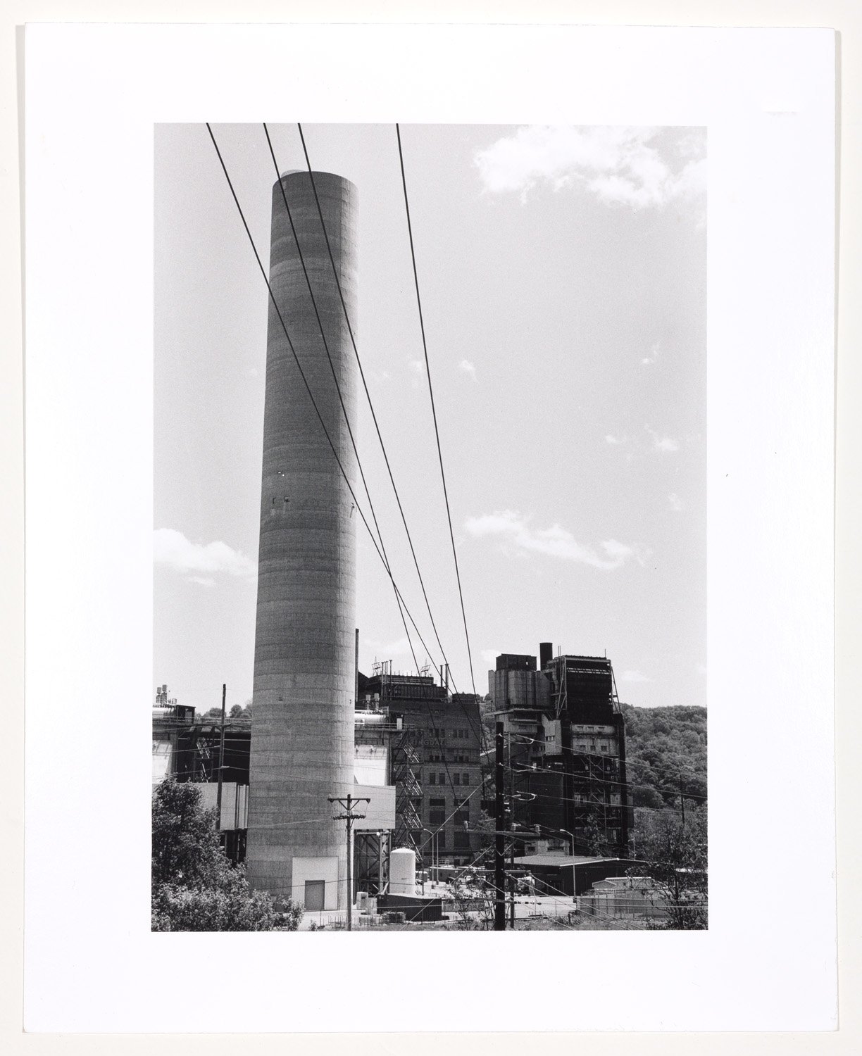
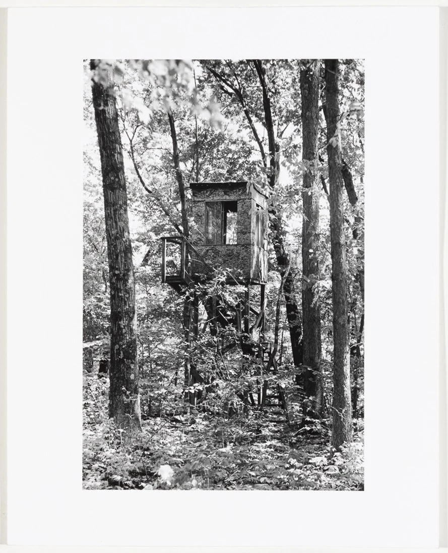
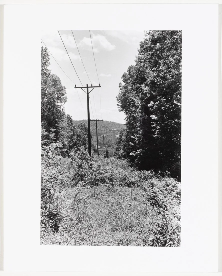
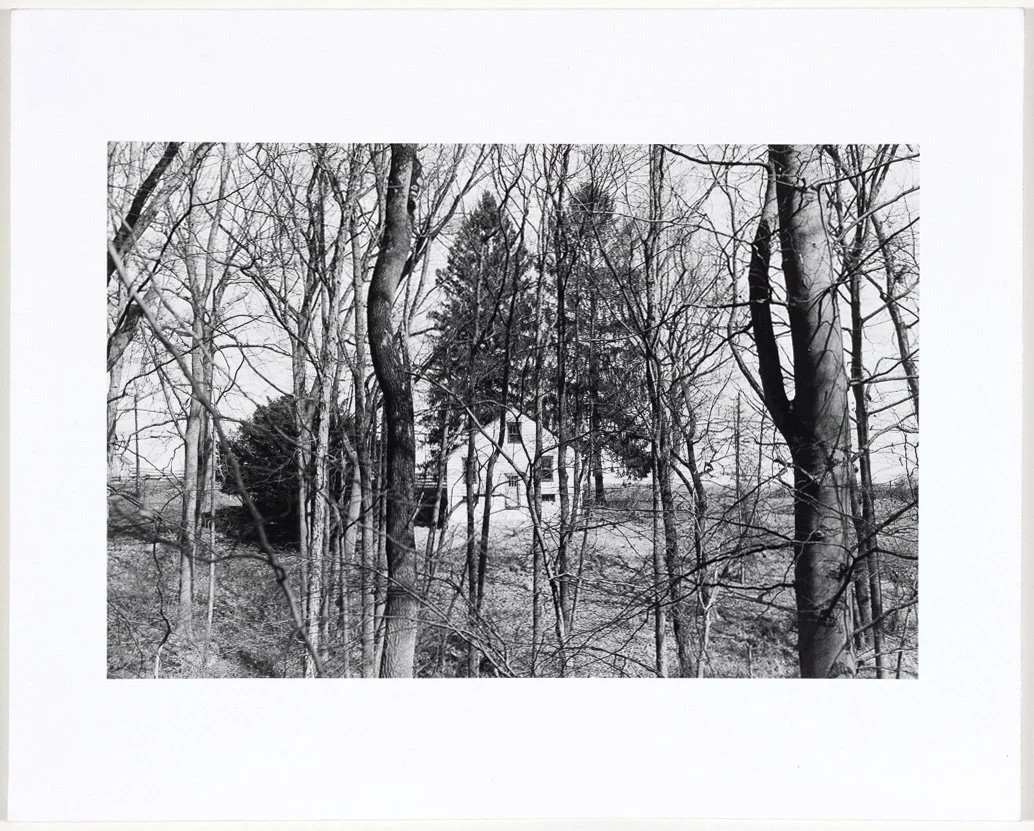
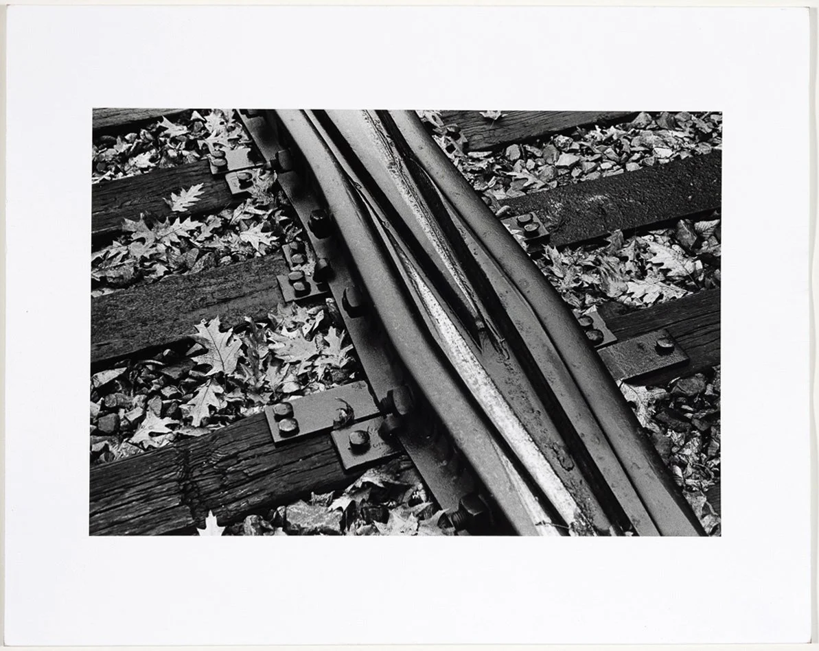
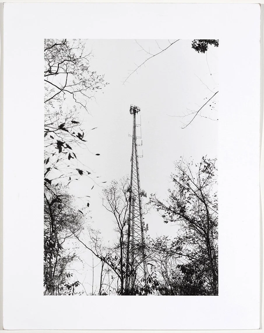
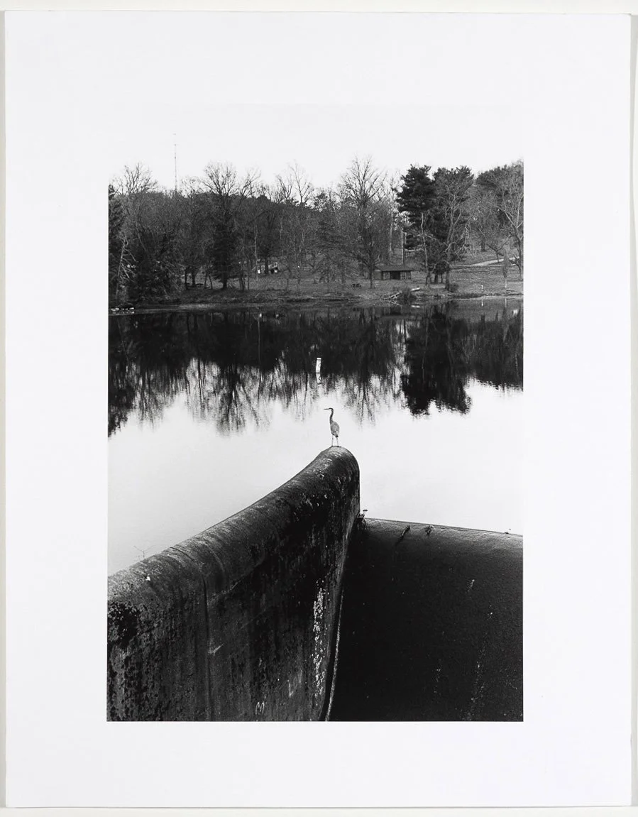
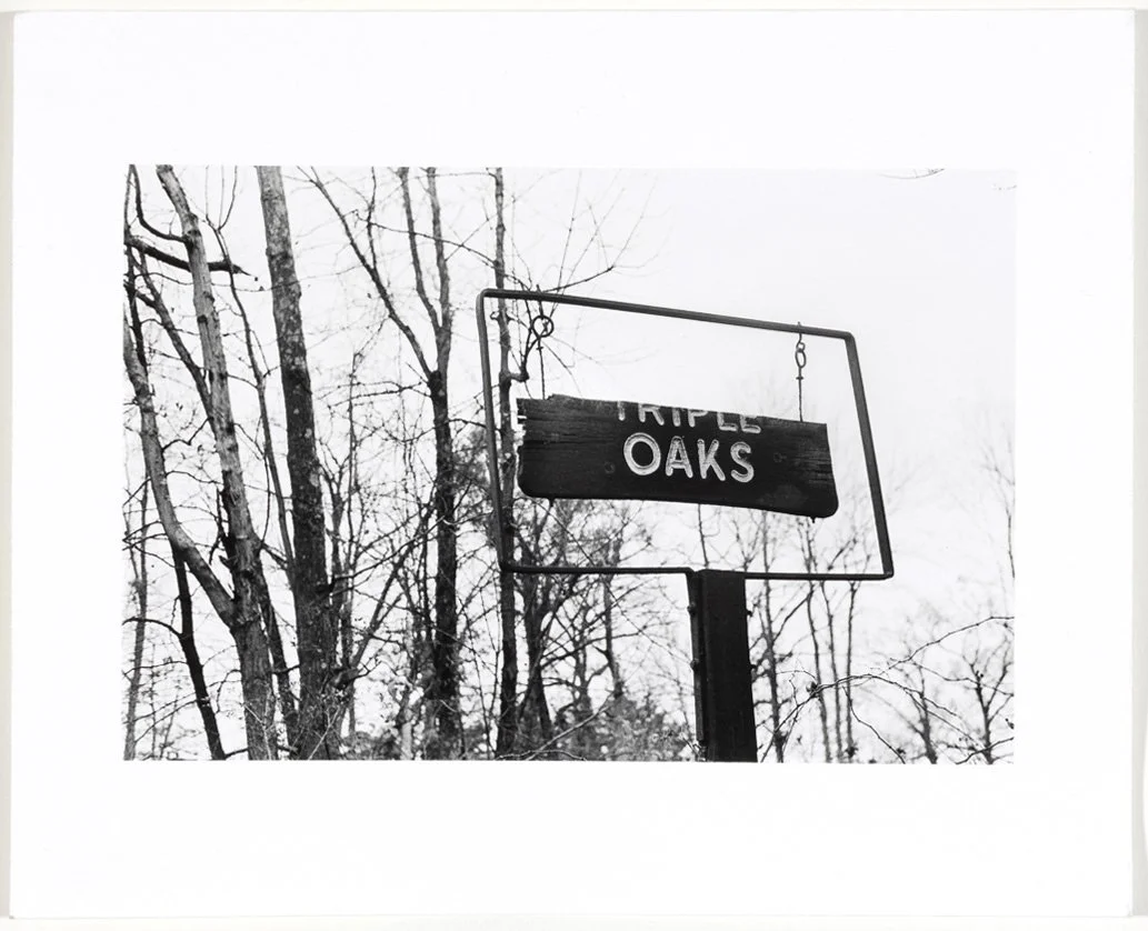
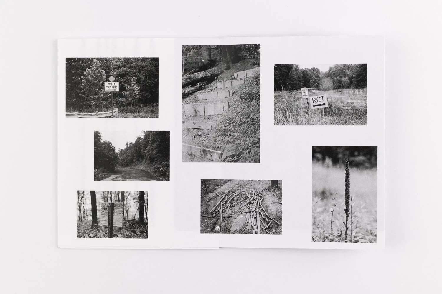
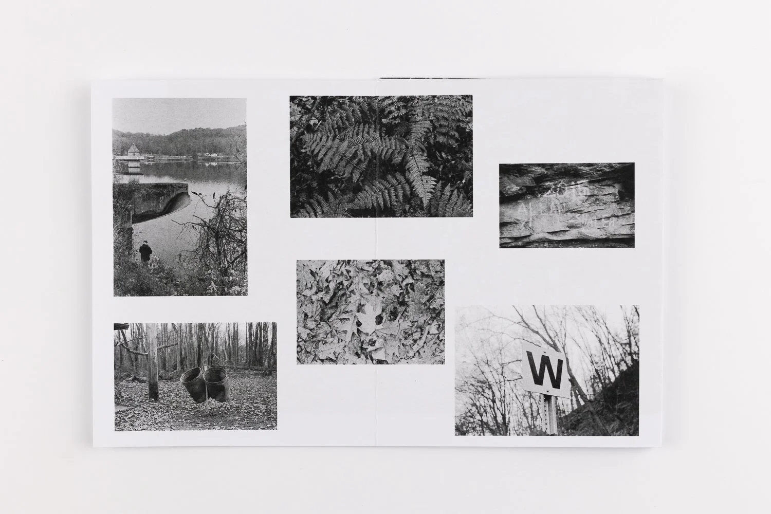
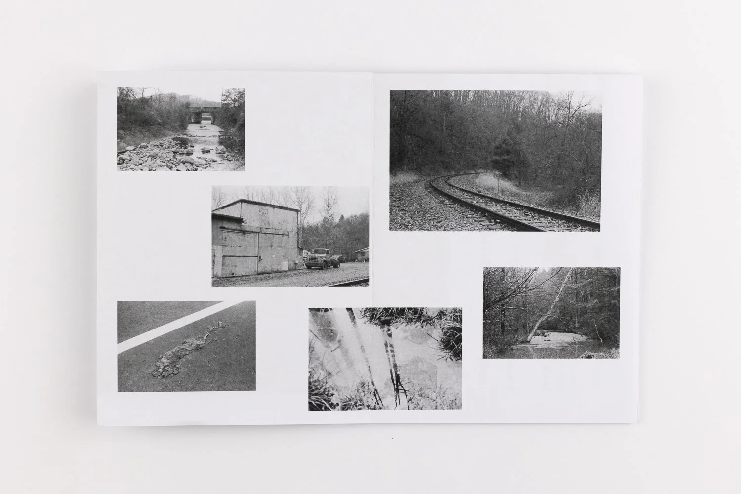
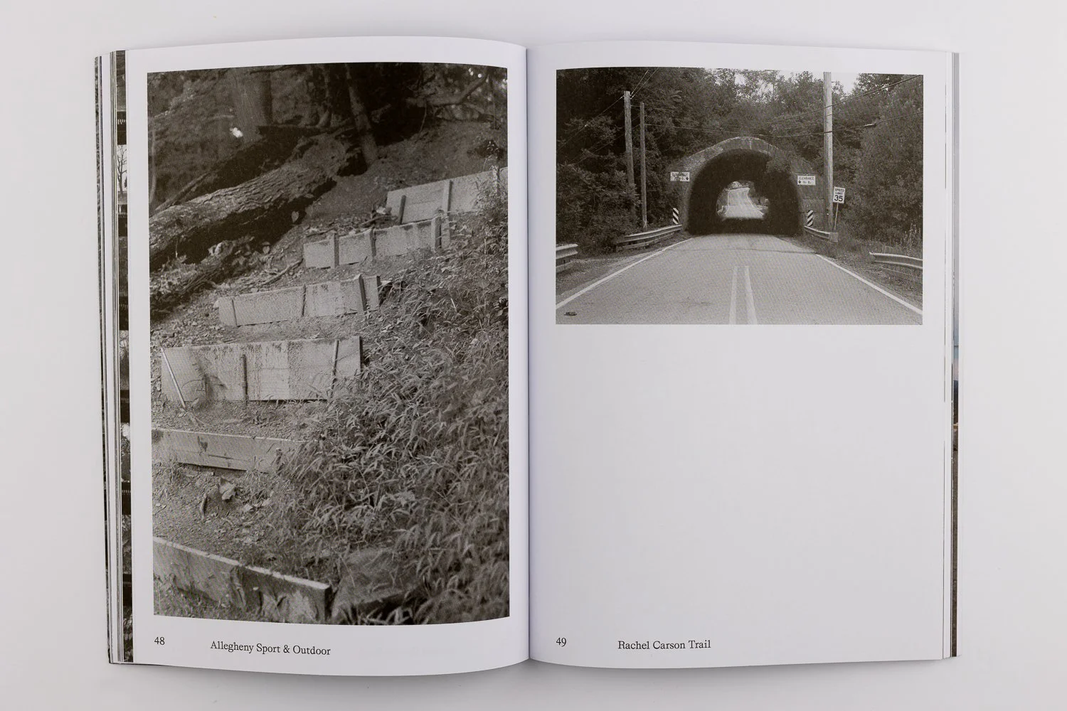
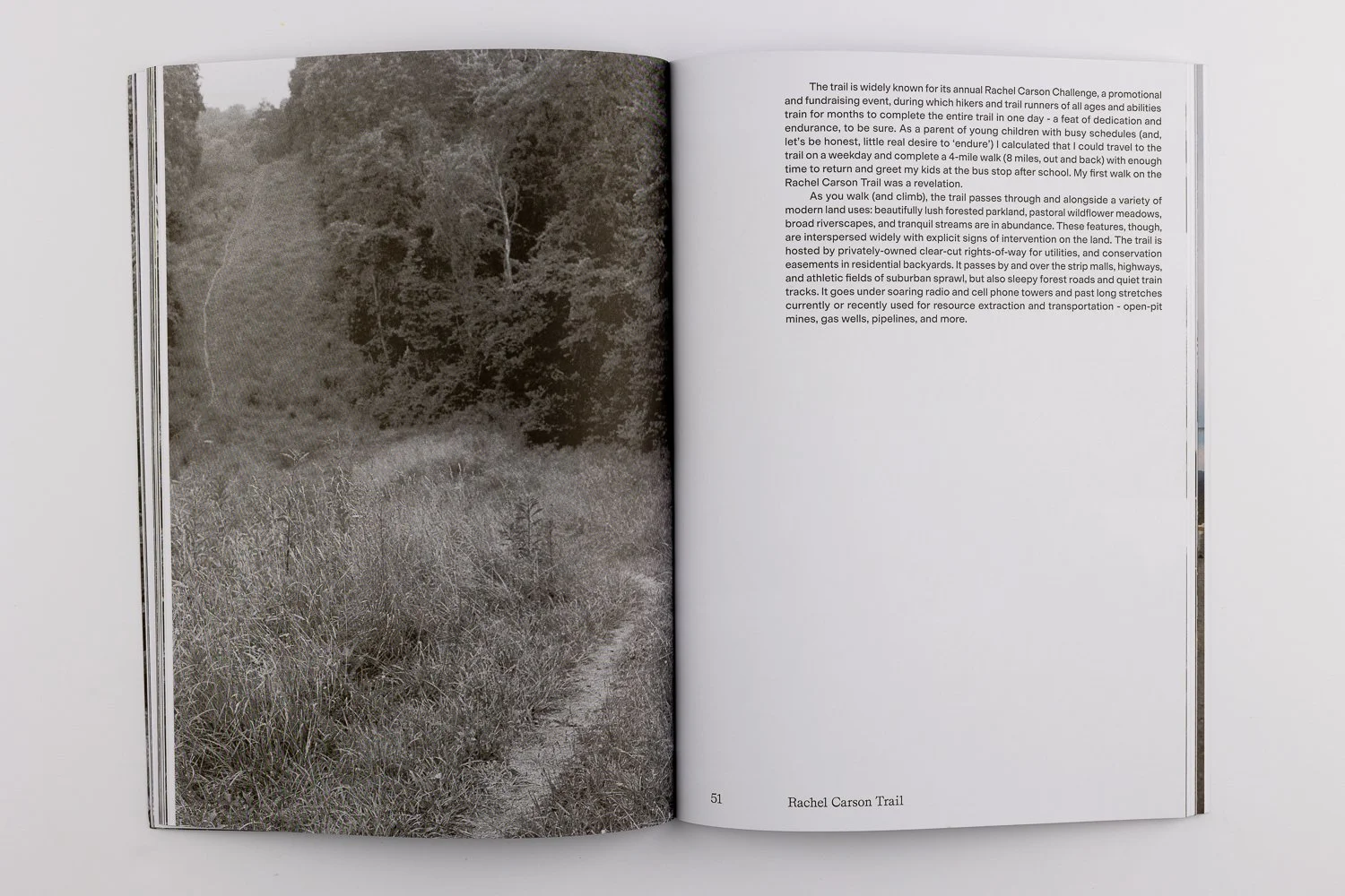
As you walk (and climb), the trail passes through and alongside a variety of modern land uses: beautifully lush forested parkland, pastoral wildflower meadows, broad riverscapes, and tranquil streams are in abundance. These features, though, are interspersed widely with explicit signs of intervention on the land. The trail is hosted by privately-owned clear-cut rights-of-way for utilities, and conservation easements in residential backyards. It passes by and over the strip malls, highways, and athletic fields of suburban sprawl, but also sleepy forest roads and quiet train tracks. It goes under soaring radio and cell phone towers and past long stretches currently or recently used for resource extraction and transportation - open-pit mines, gas wells, pipelines, and more.
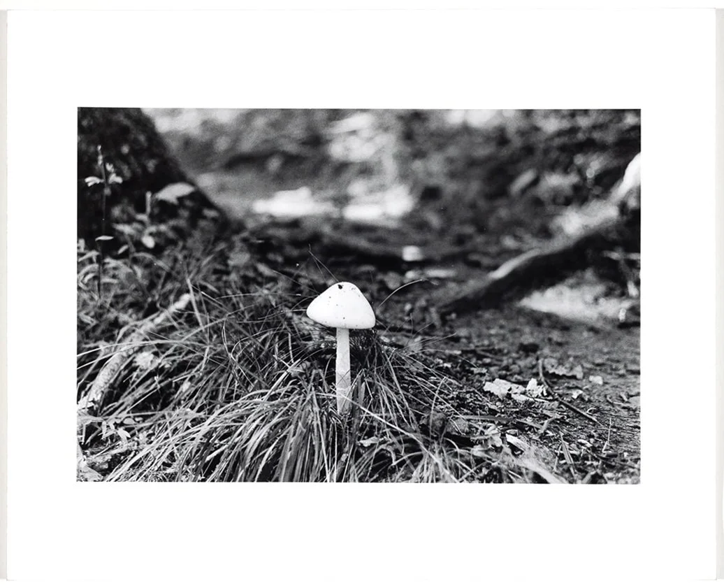
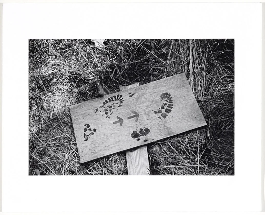
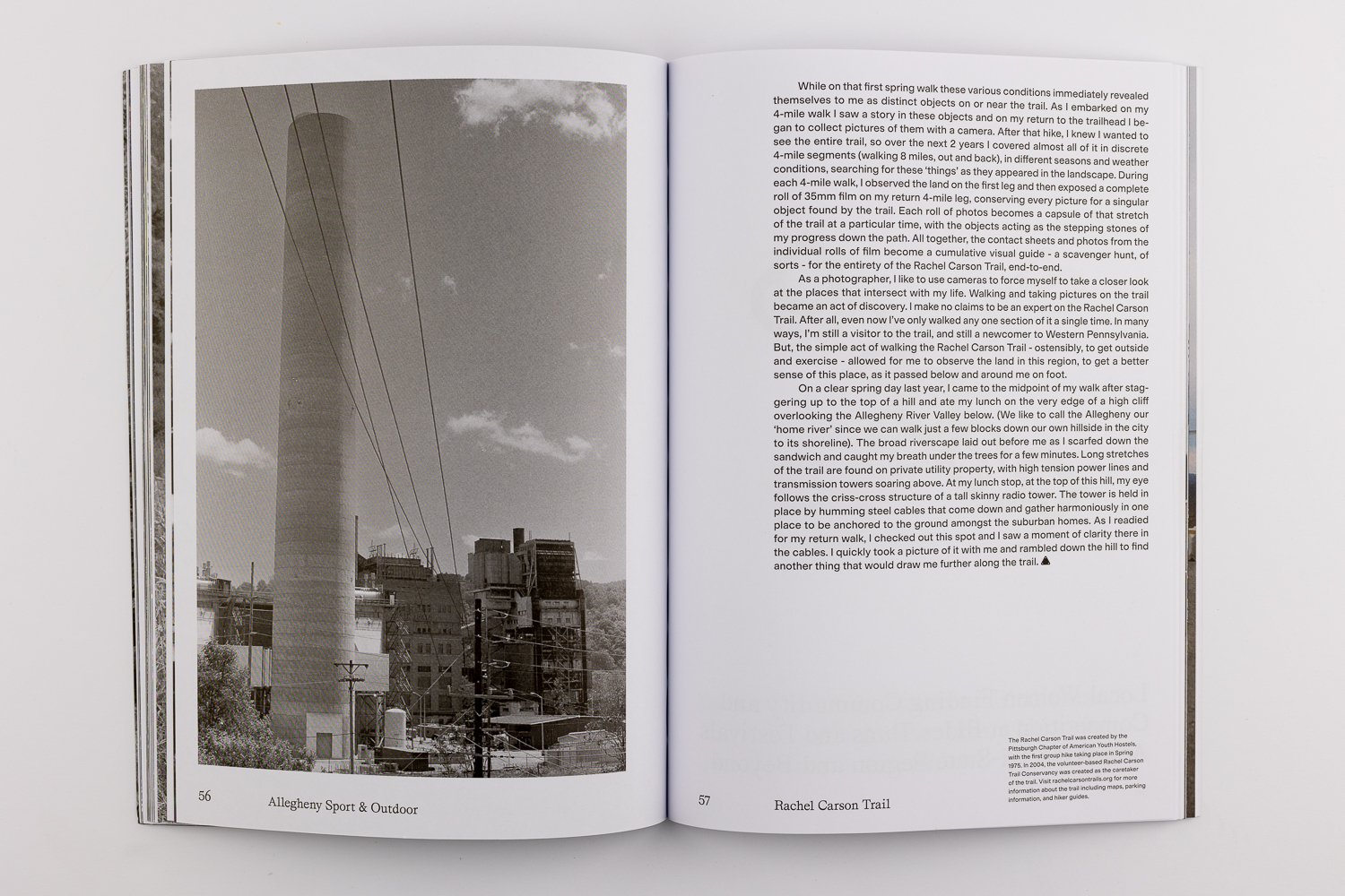
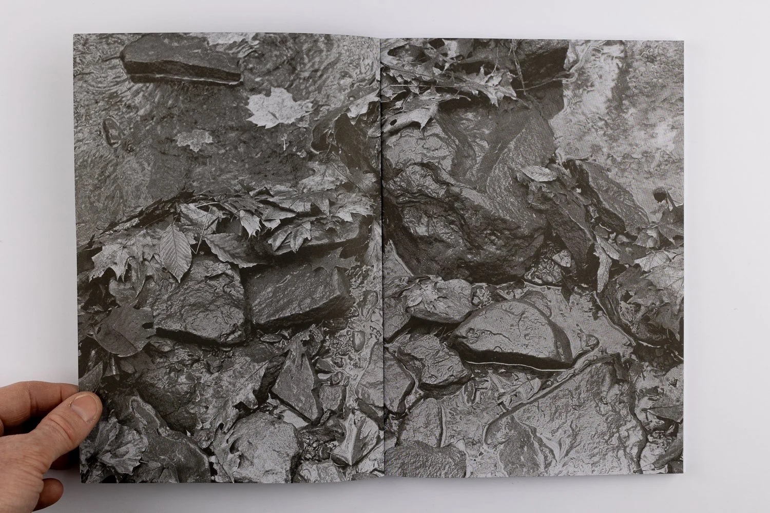
While on that first spring walk these various conditions immediately revealed themselves to me as distinct objects on or near the trail. As I embarked on my 4-mile walk I saw a story in these objects and on my return to the trailhead I began to collect pictures of them with a camera. After that hike, I knew I wanted to see the entire trail, so over the next 2 years I covered almost all of it in discrete 4-mile segments (walking 8 miles, out and back), in different seasons and weather conditions, searching for these ‘things’ as they appeared in the landscape. During each 4-mile walk, I observed the land on the first leg and then exposed a complete roll of 35mm film on my return 4-mile leg, conserving every picture for a singular object found by the trail. Each roll of photos becomes a capsule of that stretch of the trail at a particular time, with the objects acting as the stepping stones of my progress down the path. All together, the contact sheets and photos from the individual rolls of film become a cumulative visual guide - a scavenger hunt, of sorts - for the entirety of the Rachel Carson Trail, end-to-end.
As a photographer, I like to use cameras to force myself to take a closer look at the places that intersect with my life. Walking and taking pictures on the trail became an act of discovery. I make no claims to be an expert on the Rachel Carson Trail. After all, even now I’ve only walked any one section of it a single time. In many ways, I’m still a visitor to the trail, and still a newcomer to Western Pennsylvania. But, the simple act of walking the Rachel Carson Trail - ostensibly, to get outside and exercise - allowed for me to observe the land in this region, to get a better sense of this place, as it passed below and around me on foot.
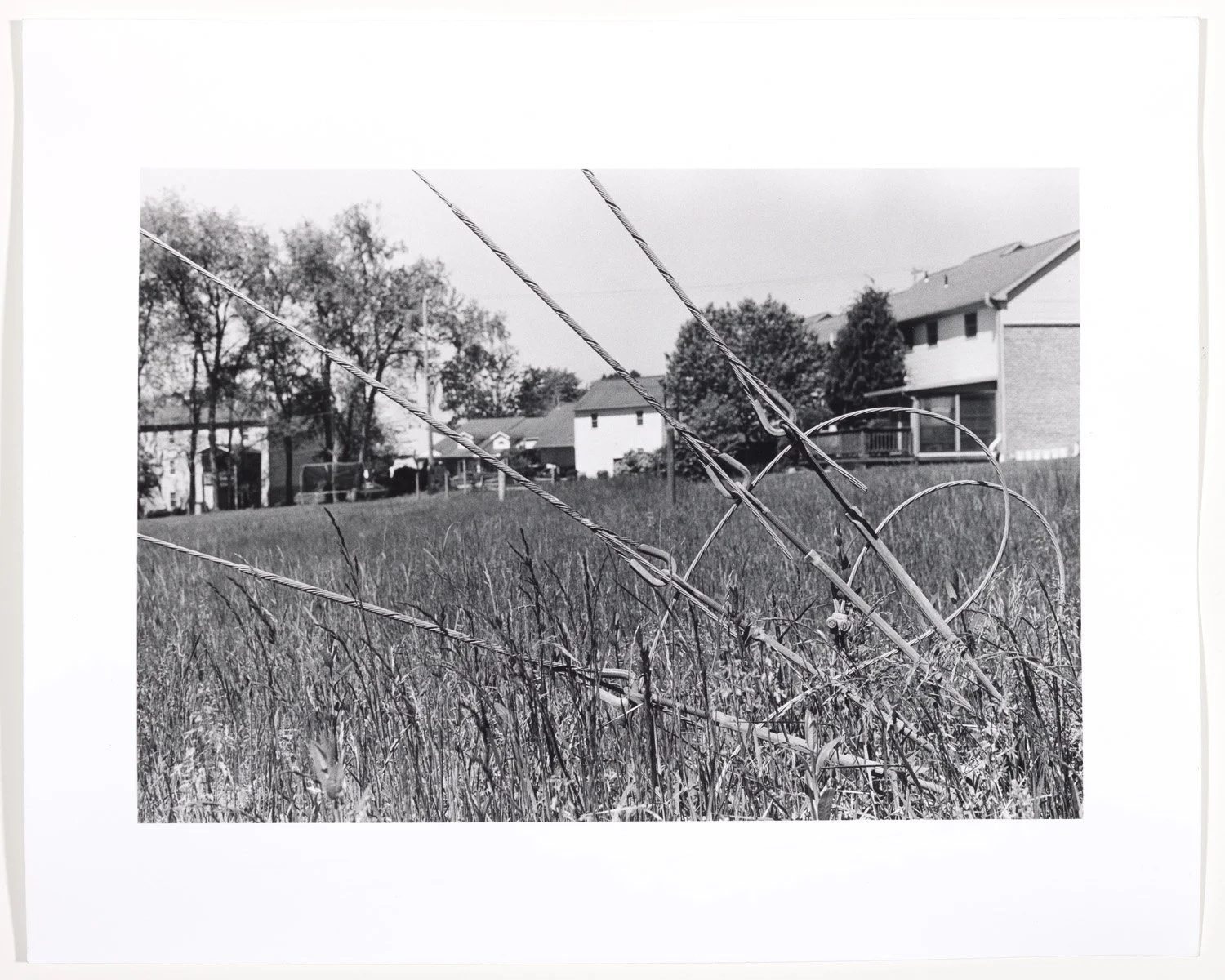
On a clear spring day last year, I came to the midpoint of my walk after staggering up to the top of a hill and ate my lunch on the very edge of a high cliff overlooking the Allegheny River Valley below. (We like to call the Allegheny our ‘home river’ since we can walk just a few blocks down our own hillside in the city to its shoreline). The broad riverscape laid out before me as I scarfed down the sandwich and caught my breath under the trees for a few minutes. Long stretches of the trail are found on private utility property, with high tension power lines and transmission towers soaring above. At my lunch stop, at the top of this hill, my eye follows the criss-cross structure of a tall skinny radio tower. The tower is held in place by humming steel cables that come down and gather harmoniously in one place to be anchored to the ground amongst the suburban homes. As I readied for my return walk I checked out this spot and I saw a moment of clarity there in the cables. I quickly took a picture of it with me and rambled down the hill to find another thing that would draw me further along the trail.
.:.
The Rachel Carson Trail was created by the Pittsburgh Chapter of American Youth Hostels, with the first group hike taking place in Spring 1975. In 2004, the volunteer-based Rachel Carson Trail Conservancy was created as the caretaker of the trail. Visit rachelcarsontrails.org for more information about the trail including maps, parking information, and hiker guides.